 ## Features
| | |
|---|---|
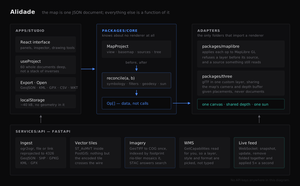
| **Data in** | Drop a GeoJSON, zipped Shapefile, GeoPackage, KML or GPX — reprojected by ogr2ogr into PostGIS and served back as vector tiles in the same request. Or paste a link and GDAL reads it over HTTP. Or point at a WMS and pick a layer from GetCapabilities. |
| **Imagery** | GeoTIFFs converted once to Cloud-Optimised GeoTIFFs and indexed by their real footprint. Tiles are mosaicked on demand under a rule you choose — newest, closest to a date, sharpest, best covering, or one locked image — with band selection, stretch and band maths as query parameters rather than as decisions frozen at import. |
| **Symbology** | Single, graduated and categorised, with markers, labels and per-layer scale ranges. |
| **Filters** | A filter is a structure, not a string, so one filter compiles two ways: a renderer expression and parameterised SQL. The inspector will show you the SQL. |
| **Identify** | Click a feature for its attributes, or the imagery for the pixel values under the cursor. The attribute table pages, searches, sorts and hides columns, and highlights on the map what you select in it. |
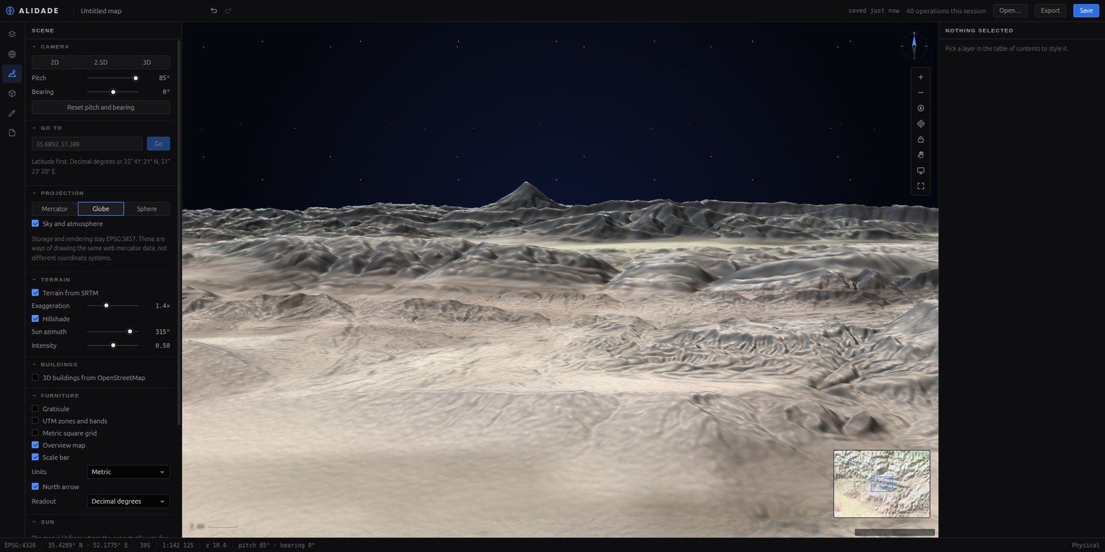
| **2D · 2.5D · 3D** | Three projections including a real globe, terrain and hillshade from open elevation tiles, and OSM building footprints raised to their real height. |
| **3D models** | glTF placed the way a surveyor states it — position, height, bearing, scale — standing on the terrain, lit by the real sun for a real instant, casting real shadows. One model can be placed at every point of a layer. |
| **Live assets** | Positions over a WebSocket as an ordinary row in the table of contents. Assets that go quiet are drawn hollow, not deleted. A model can stand in for one and take its heading, climb and bank from the reports. |
| **Drawing** | Geodesic measurement, buffers, snapping, vertex editing. Exports to GeoJSON, KML, GPX, CSV or WKT — and reads all of them back. |
| **Chrome** | Graticule, UTM and metric grids, overview map, scale bar in three unit systems, coordinate readout in DD, DMS or UTM, bookmarks. |
## What it looks like
## Features
| | |
|---|---|
| **Data in** | Drop a GeoJSON, zipped Shapefile, GeoPackage, KML or GPX — reprojected by ogr2ogr into PostGIS and served back as vector tiles in the same request. Or paste a link and GDAL reads it over HTTP. Or point at a WMS and pick a layer from GetCapabilities. |
| **Imagery** | GeoTIFFs converted once to Cloud-Optimised GeoTIFFs and indexed by their real footprint. Tiles are mosaicked on demand under a rule you choose — newest, closest to a date, sharpest, best covering, or one locked image — with band selection, stretch and band maths as query parameters rather than as decisions frozen at import. |
| **Symbology** | Single, graduated and categorised, with markers, labels and per-layer scale ranges. |
| **Filters** | A filter is a structure, not a string, so one filter compiles two ways: a renderer expression and parameterised SQL. The inspector will show you the SQL. |
| **Identify** | Click a feature for its attributes, or the imagery for the pixel values under the cursor. The attribute table pages, searches, sorts and hides columns, and highlights on the map what you select in it. |
| **2D · 2.5D · 3D** | Three projections including a real globe, terrain and hillshade from open elevation tiles, and OSM building footprints raised to their real height. |
| **3D models** | glTF placed the way a surveyor states it — position, height, bearing, scale — standing on the terrain, lit by the real sun for a real instant, casting real shadows. One model can be placed at every point of a layer. |
| **Live assets** | Positions over a WebSocket as an ordinary row in the table of contents. Assets that go quiet are drawn hollow, not deleted. A model can stand in for one and take its heading, climb and bank from the reports. |
| **Drawing** | Geodesic measurement, buffers, snapping, vertex editing. Exports to GeoJSON, KML, GPX, CSV or WKT — and reads all of them back. |
| **Chrome** | Graticule, UTM and metric grids, overview map, scale bar in three unit systems, coordinate readout in DD, DMS or UTM, bookmarks. |
## What it looks like
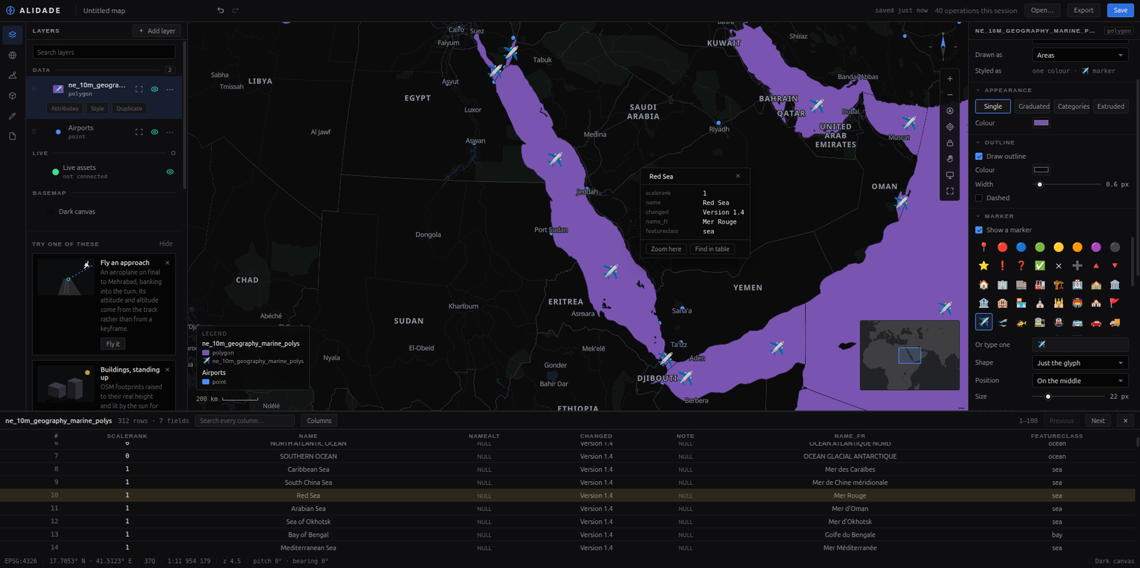 Layers, styled. Markers, outlines and a legend that follows what you set, over data loaded from a link a minute earlier. |
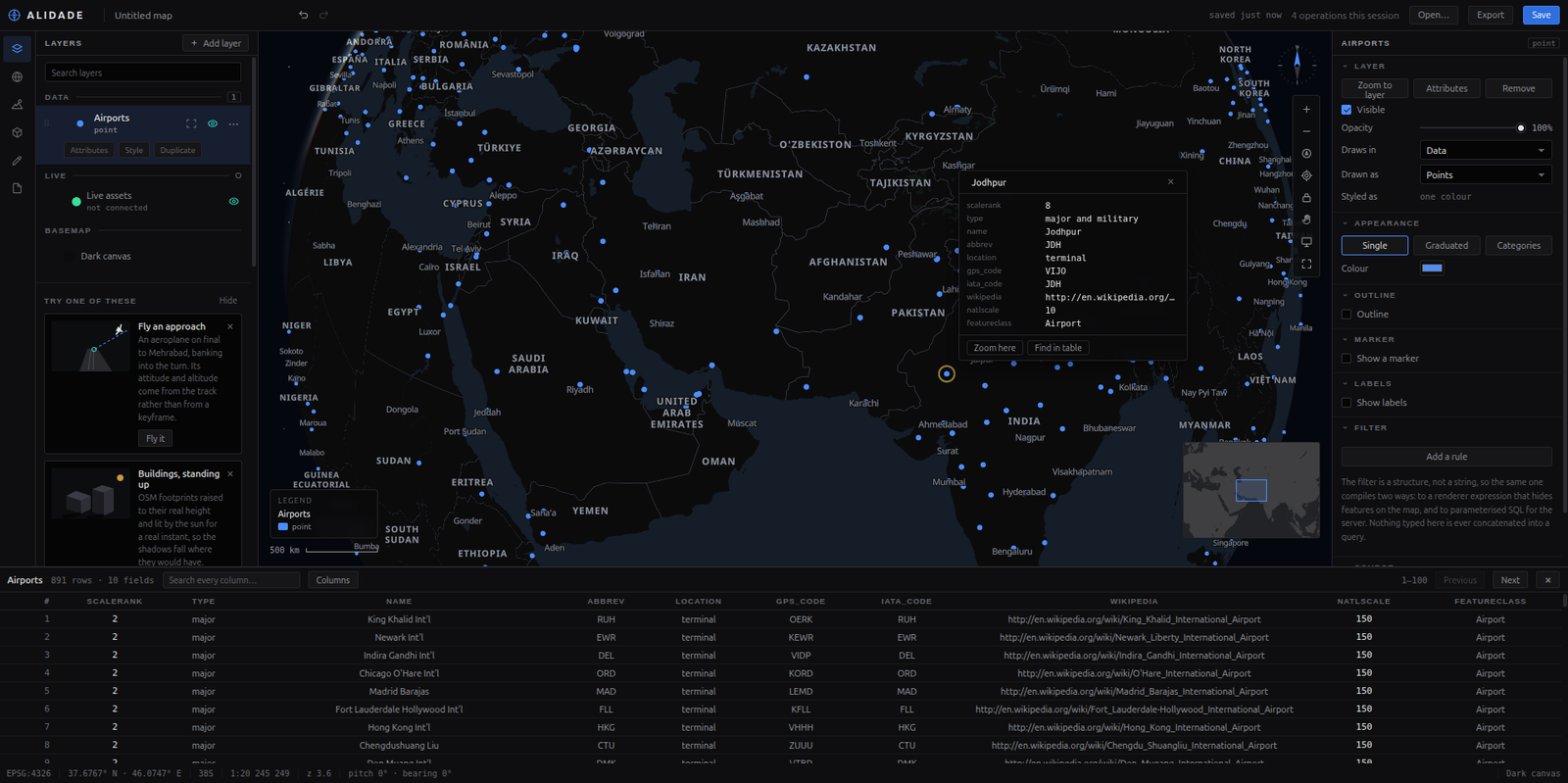 Ask it things. Click a feature for what it is; the table pages, searches and finds the same row. |
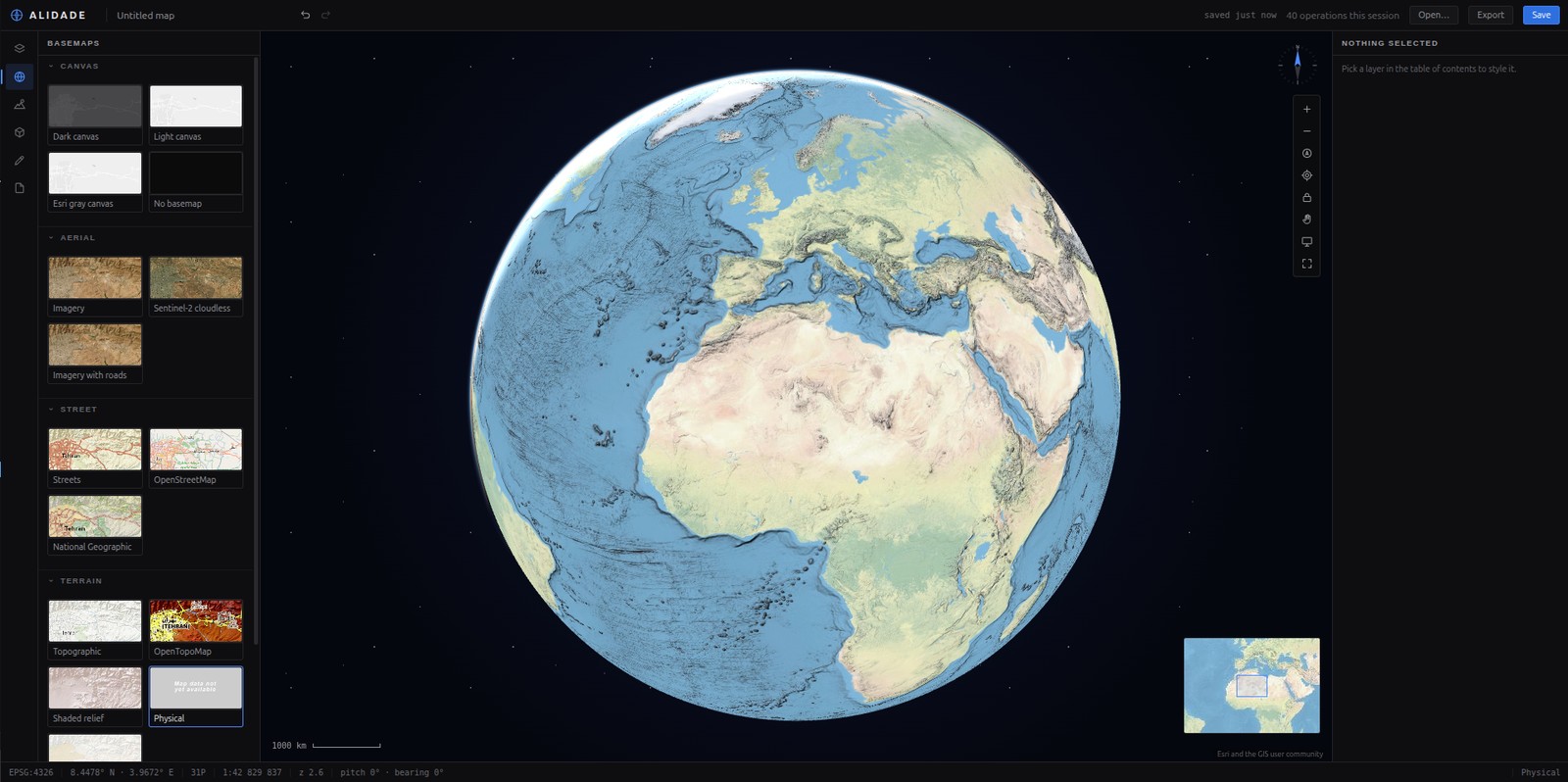 A real globe, not a picture of one — and a sphere at every zoom if you ask for one. |
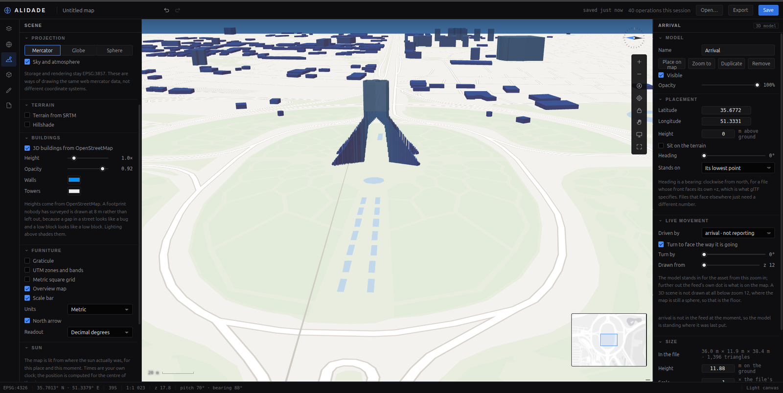 3D buildings from OpenStreetMap. Footprints extruded to their real height, lit from where the sun actually was. |
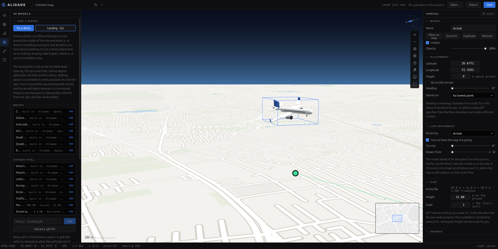 Fly a landing. The aircraft banks because it is turning, not because a keyframe said so. |
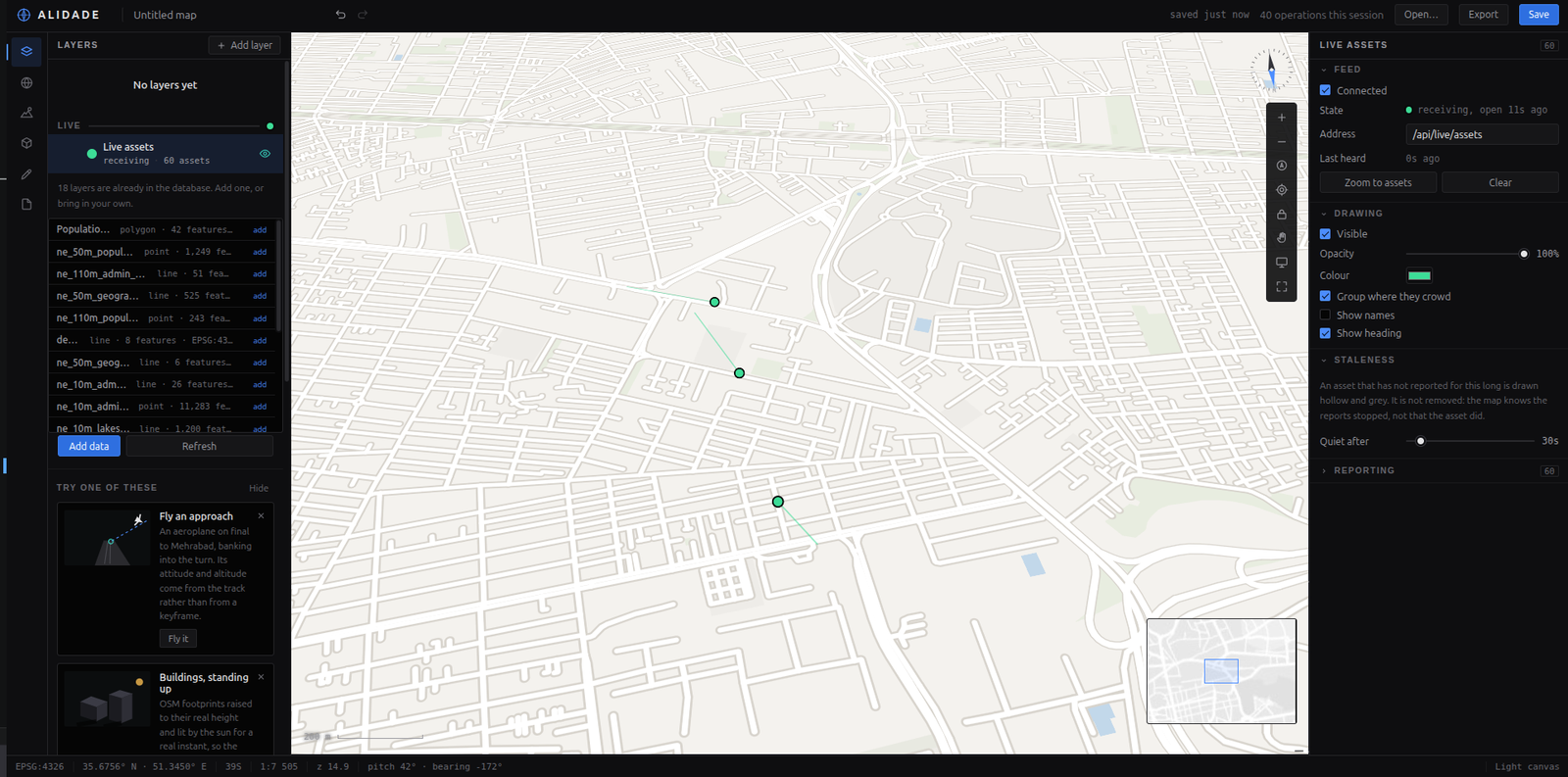 A live fleet over a WebSocket, with a connection light, because a stopped feed and a still fleet look identical. |
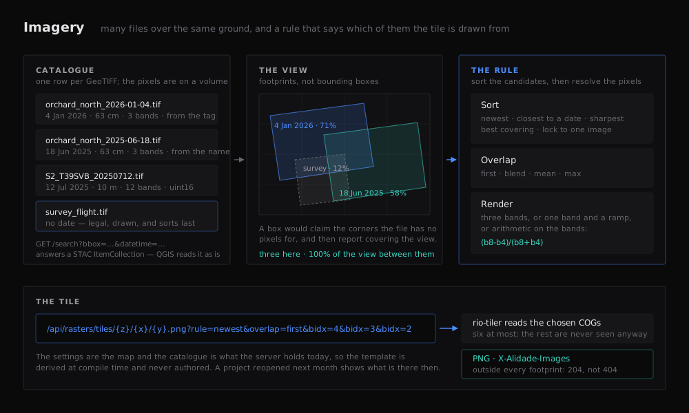 Imagery. A schematic rather than a screenshot: what is on the map is whatever you loaded. See the imagery notes. |
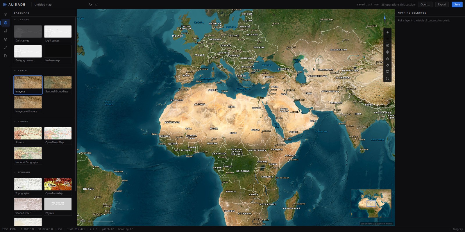 Basemaps, none of which need a key. Swapping one does not disturb your layers. |