Geoplot: geospatial data visualization


About
geoplot is a high-level Python geospatial plotting library. It’s an extension to cartopy and matplotlib
which makes mapping easy: like seaborn for geospatial. It comes with the following features:
- High-level plotting API:
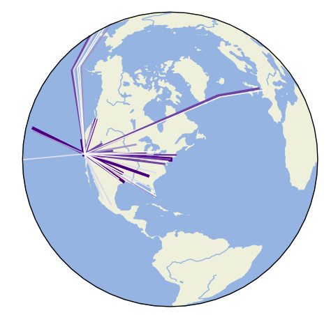
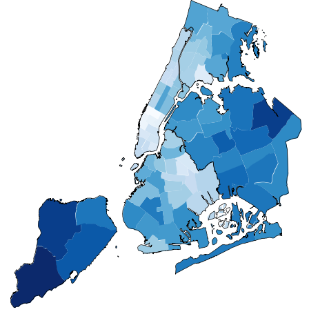
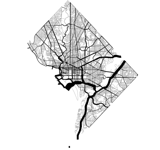
geoplotis cartographic plotting for the 90% of use cases. All of the standard-bearermaps that you’ve probably seen in your geography textbook are easily accessible. - Native projection support: The most fundamental peculiarity of geospatial plotting is projection: how do you unroll a sphere onto a flat surface (a map) in an accurate way? The answer depends on what you’re trying to depict.
geoplotprovides these options. - Compatibility with matplotlib: While
matplotlibis not a good fit for working with geospatial data directly, it’s a format that’s well-incorporated by other tools. - Built with modern geospatial Python in mind: Innovations in recent years have made working with geospatial data easier than ever, which geoplot leverages with an easy-to-use and widely compatible API.
Browse the Gallery to see what geoplot can do, then jump into the
Quickstart
or the API Reference to see how to do it. For help installing, check out
Installation.
Documentation