 |
Catchment Characterisation and Modelling (CCM)
CCM Workshop AGILE Helsinki 2016
Coastline coding website online! Global Coastline Reference Definition
Drainage networks and associated drainage basins form complex functional entities not only for hydrological processes but also for environmental processes at large. In order to study the underlying processes and cause-effect relationships at regional to European scales, comprehensive digital data of river networks, drainage basins (catchments) and their characteristics are required.
JRC's Catchment Characterisation and Modelling (CCM) activity responded to this need through the development of a pan-European database of river networks and catchments. Version 1.0 of CCM has been published in 2003. In July 2007 an geographically extended and substantially improved CCM Version 2.0 has been released. The current Version 2.1 of July 2008 is an update of version 2.0. It includes the correction of noted errors as well additional functionality. A detailed report on the development of CCM 2.0 as well Release Notes for CCM 2.1 are provided below.
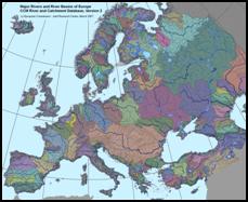
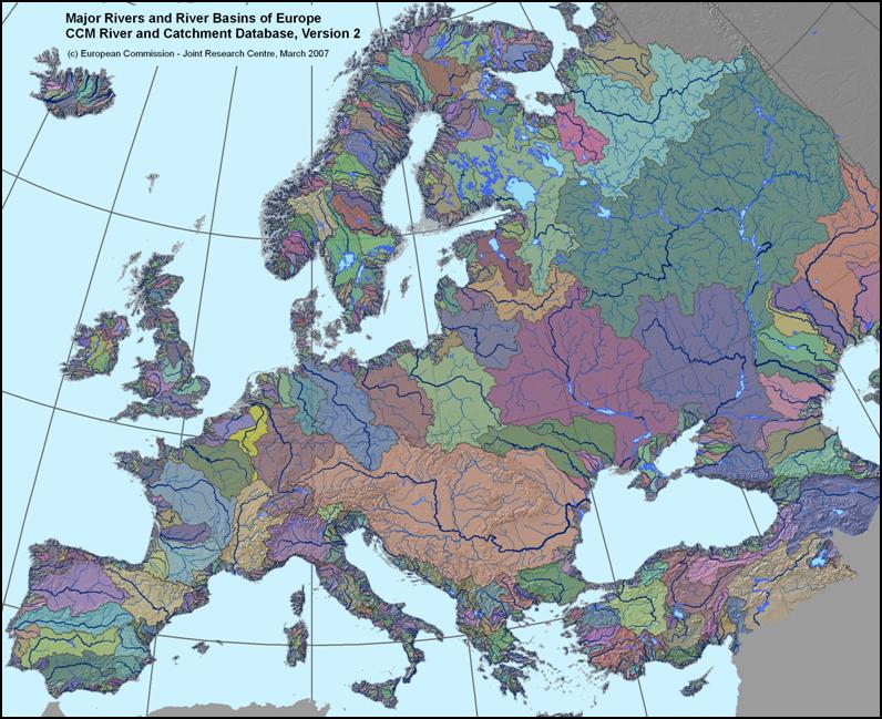
CCM River and Catchment Database, version 2.1 (CCM2)
The CCM2 database covers the entire European continent, including the Atlantic islands, Iceland and Turkey.
It includes a hierarchical set of river segments and catchments based on the Strahler order, a lake layer and structured hydrological
feature codes based on the Pfafstetter system.
Data Download:
CCM data are made freely available for non-commercial use.
To download CCM2 data Click Here
An overview of the Geographical spread of the CCM user community you can find here
For more information on the development and characteristics of the CCM2 database see:
|
|
- de Jager, A.L., Vogt, J.V. (2010). Development and demonstration of a structured hydrological feature coding system for Europe , Hydrological Sciences Journal, 55, 5, 661, Taylor and Francis
(Internet Access)
- Vogt, J.V. et al. (2007). A pan-European River and Catchment Database. EC-JRC (Report EUR 22920 EN) Luxembourg, 120 p.
(PDF standard - 9.8 MB)
(PDF high quality print - 37.0 MB)
- Vogt, J.V. et al. (2007). Developing a pan-European Data Base of Drainage Networks and Catchment Boundaries from a 100
Metre DEM. Proceedings AGILE International Conference, May 2007.
(PDF standard - 0.5 MB)
- Vogt, J.V., E. Rimaviciute, A de Jager (2008). CCM 2.1 Release Notes.
(PDF standard)
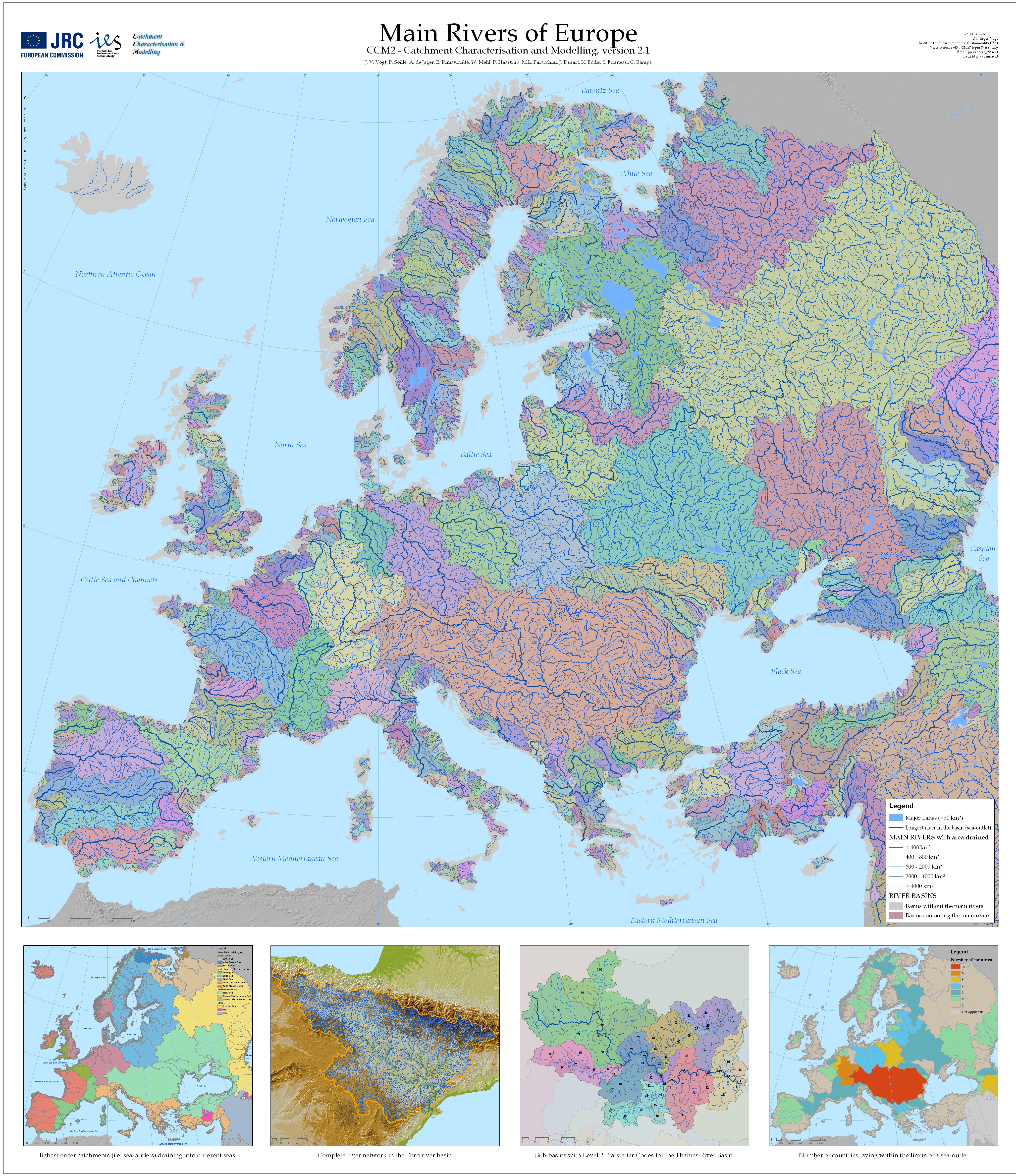
- E. Rimaviciute, Example Maps Main Rivers
JPG 14 Mb
PDF 40 Mb.
- JRC Data Catalogue Webmapping Viewer Press Preview and find CCM products in the Imported Tab.
| Last update: Monday 18 January 2016 |
Page 23 created on: Thursday 1 March 2007 |
|

