# Planetiler
Planetiler is a tool that generates [Vector Tiles](https://github.com/mapbox/vector-tile-spec/tree/master/2.1)
from geographic data sources like [OpenStreetMap](https://www.openstreetmap.org/). Planetiler aims to be fast and
memory-efficient so that you can build a map of the world in a few hours on a single machine without any external tools
or database.
Vector tiles contain raw point, line, and polygon geometries that clients like [MapLibre](https://github.com/maplibre)
can use to render custom maps in the browser, native apps, or on a server. Planetiler packages tiles into
an [MBTiles](https://github.com/mapbox/mbtiles-spec/blob/master/1.3/spec.md) (sqlite)
or [PMTiles](https://github.com/protomaps/PMTiles) file that can be served using tools
like [TileServer GL](https://github.com/maptiler/tileserver-gl) or [Martin](https://github.com/maplibre/martin) or
even [queried directly from the browser](https://github.com/protomaps/PMTiles/tree/main/js).
See [awesome-vector-tiles](https://github.com/mapbox/awesome-vector-tiles) for more projects that work with data in this
format.
Several full-featured basemaps are built using planetiler:
- [OpenMapTiles](https://github.com/openmaptiles/planetiler-openmaptiles)
- [Protomaps Basemaps](https://github.com/protomaps/basemaps/tree/main/tiles)
- [Shortbread](./planetiler-custommap/src/main/resources/samples/shortbread.yml)
You can also create your own custom base maps or overlays
using [YAML](#option-1-custom-maps-using-yaml-no-java-required)
or [Java](#option-2-custom-maps-using-java-profiles).
Planetiler works by mapping input elements to vector tile features, flattening them into a big list, then sorting by
tile ID to group into tiles. See [ARCHITECTURE.md](ARCHITECTURE.md) for more details
or this [blog post](https://medium.com/@onthegomap/dc419f3af75d?source=friends_link&sk=fb71eaa0e2b26775a9d98c81750ec10b)
for more of the backstory.
## Demo
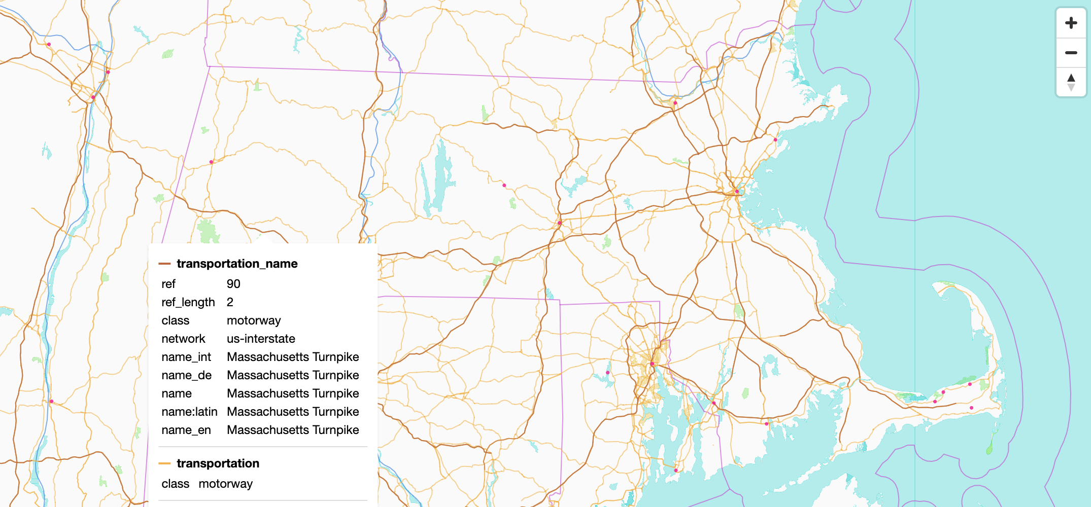
See the [live demo](https://onthegomap.github.io/planetiler-demo/) of vector tiles created by Planetiler
and [hosted by OpenStreetMap US](https://github.com/osmus/tileservice).
[](https://onthegomap.github.io/planetiler-demo/)
[© OpenMapTiles](https://www.openmaptiles.org/) [© OpenStreetMap contributors](https://www.openstreetmap.org/copyright)
## Usage
To generate a map of an area using the [OpenMapTiles profile](https://github.com/openmaptiles/planetiler-openmaptiles),
you will need:
- Java 25+ (see [CONTRIBUTING.md](CONTRIBUTING.md)) or [Docker](https://docs.docker.com/get-docker/)
- at least 1GB of free SSD disk space plus 5-10x the size of the `.osm.pbf` file
- at least 0.5x as much free RAM as the input `.osm.pbf` file size
#### To build the map:
Using Java, download `planetiler.jar` from
the [latest release](https://github.com/onthegomap/planetiler/releases/latest)
and run it:
```bash
wget https://github.com/onthegomap/planetiler/releases/latest/download/planetiler.jar
java -Xmx1g -jar planetiler.jar --download --area=monaco
```
Or using Docker:
```bash
docker run -e JAVA_TOOL_OPTIONS="-Xmx1g" -v "$(pwd)/data":/data ghcr.io/onthegomap/planetiler:latest --download --area=monaco
```
:warning: This starts off by downloading about 1GB of [data sources](NOTICE.md#data) required by the OpenMapTiles
profile
including ~750MB for ocean polygons and ~240MB
for [Natural Earth Data](https://www.naturalearthdata.com/).
To download smaller extracts just for Monaco:
Java:
```bash
java -Xmx1g -jar planetiler.jar --download --area=monaco \
--water-polygons-url=https://github.com/onthegomap/planetiler/raw/main/planetiler-core/src/test/resources/water-polygons-split-3857.zip \
--natural-earth-url=https://github.com/onthegomap/planetiler/raw/main/planetiler-core/src/test/resources/natural_earth_vector.sqlite.zip
```
Docker:
```bash
docker run -e JAVA_TOOL_OPTIONS="-Xmx1g" -v "$(pwd)/data":/data ghcr.io/onthegomap/planetiler:latest --download --area=monaco \
--water-polygons-url=https://github.com/onthegomap/planetiler/raw/main/planetiler-core/src/test/resources/water-polygons-split-3857.zip \
--natural-earth-url=https://github.com/onthegomap/planetiler/raw/main/planetiler-core/src/test/resources/natural_earth_vector.sqlite.zip
```
You will need the full data sources to run anywhere besides Monaco.
#### To view tiles locally:
Generate a [pmtiles](https://docs.protomaps.com/pmtiles/) tile archive by adding `--output=data/output.pmtiles` then
drag and drop `output.pmtiles` to [pmtiles.io](https://pmtiles.io/).
Or with the default mbtiles output format, use [tileserver-gl-light](https://github.com/maptiler/tileserver-gl):
```bash
npm install -g tileserver-gl-light
tileserver-gl-light data/output.mbtiles
```
Then open http://localhost:8080 to view tiles.
Some common arguments:
- `--output` tells planetiler where to write output to, and what format to write it in. For
example `--output=australia.pmtiles` creates a pmtiles archive named `australia.pmtiles`.
It is best to specify the full path to the file. In docker image you should be using `/data/australia.pmtiles` to let
the docker know where to write the file.
- `--download` downloads input sources automatically and `--only-download` exits after downloading
- `--area=monaco` downloads a `.osm.pbf` extract from [Geofabrik](https://download.geofabrik.de/)
- `--osm-path=path/to/file.osm.pbf` points Planetiler at an existing OSM extract on disk
- `-Xmx1g` controls how much RAM to give the JVM (recommended: 0.5x the input .osm.pbf file size to leave room for
memory-mapped files)
- `--force` overwrites the output file
- `--help` shows all of the options and exits
## Generating a Map of the World
See [PLANET.md](PLANET.md).
## Generating Custom Maps
Planetiler supports custom vector tile maps in two ways, depending on how much control you need:
1. **YAML configuration (no Java required)** – for simple custom maps
2. **Java profiles** – for advanced logic and full control
Both approaches generate standard Mapbox Vector Tiles (MVT) that can be used with MapLibre GL, Mapbox GL, and other
vector-tile clients.
### Option 1: Custom Maps Using YAML (No Java Required)
For many use cases, you can define a custom vector tile map using a YAML configuration file.
This approach does not require writing Java code and is ideal for:
- Simple or moderately complex maps
- Prototyping
- Users who prefer declarative configuration
YAML-based maps are powered by the `planetiler-custommap` module. See examples and documentation:
https://github.com/onthegomap/planetiler/tree/main/planetiler-custommap.
#### Example YAML configuration
```yaml
schema_name: Roads
attribution: © OpenStreetMap contributors
sources:
osm:
type: osm
url: geofabrik:rhode-island
layers:
- id: roads
features:
- source: osm
geometry: line
min_zoom: 6
include_when:
highway: [primary, secondary, tertiary]
attributes:
- key: class
tag_value: highway
```
To run:
```bash
java -jar planetiler.jar roads.yaml --download --output=roads.pmtiles
```
### Option 2: Custom Maps Using Java Profiles
For more complex use cases, Planetiler supports custom Java profiles that allow full control over feature processing,
attributes, zoom logic, and geometry handling. Java profiles are recommended when you need:
- Complex conditional logic
- Advanced attribute derivation
- Non-trivial feature interactions
- Maximum performance tuning
See examples and documentation: https://github.com/onthegomap/planetiler-examples/.
#### Example Java profile
```java
import com.onthegomap.planetiler.*;
import com.onthegomap.planetiler.config.*;
import com.onthegomap.planetiler.reader.*;
import java.nio.file.Path;
public class Roads implements Profile {
@Override
public String attribution() {
return """
© OpenStreetMap contributors
""".trim();
}
@Override
public void processFeature(SourceFeature feature, FeatureCollector features) {
if (feature.canBeLine() && feature.hasTag("highway", "primary", "secondary", "tertiary")) {
features.line("roads").setAttr("class", feature.getTag("highway"));
}
}
public static void main(String[] args) {
Planetiler.create(Arguments.fromArgs(args)).addOsmSource("osm", Path.of("ri.osm.pbf"), "geofabrik:rhode-island")
.overwriteOutput(Path.of("roads.pmtiles"))
.setProfile(new Roads())
.run();
}
}
```
This can be run with Java 22 or later without any compile step or build tools:
```bash
java -cp planetiler.jar Roads.java --download --output=roads.pmtiles
```
## Use as a library
For larger projects with other dependencies, Planetiler can be used as a maven-style dependency in a Java project
using the settings below:
### Maven
Add this repository block to your `pom.xml`:
```xml
osgeo
OSGeo Release Repository
https://repo.osgeo.org/repository/release/
false
true
```
Then add the following dependency:
```xml
com.onthegomap.planetiler
planetiler-core
${planetiler.version}
```
### Gradle
Set up your repositories block::
```groovy
mavenCentral()
maven {
url "https://repo.osgeo.org/repository/release/"
}
```
Set up your dependencies block:
```groovy
implementation 'com.onthegomap.planetiler:planetiler-core:'
```
### Git submodules
Planetiler has a submodule dependency
on [planetiler-openmaptiles](https://github.com/openmaptiles/planetiler-openmaptiles). Add `--recurse-submodules`
to `git clone`, `git pull`, or `git checkout` commands to also update submodule dependencies.
To clone the repo with submodules:
```bash
git clone --recurse-submodules https://github.com/onthegomap/planetiler.git
```
If you already pulled the repo, you can initialize submodules with:
```bash
git submodule update --init
```
To force git to always update submodules (recommended), run this command in your local repo:
```bash
git config --local submodule.recurse true
```
Learn more about working with submodules [here](https://git-scm.com/book/en/v2/Git-Tools-Submodules).
## Benchmarks
Some example runtimes for the OpenMapTiles profile (excluding downloading resources):
| Input | Version | Machine | Time | output size | Logs |
|------------------------------------------------|---------|---------------------------------|---------------------------|--------------|----------------------------------------------------------------------------------------------------------------|
| s3://osm-pds/2026/planet-260302.osm.pbf (92GB) | 0.10.1 | h4d-standard-192 (192cpu/720GB) | 19m cpu:37h59m avg:117 | 81GB pmtiles | [logs](planet-logs/v0.10.1-planet-h4d-standard-192-with-building-merge.txt) |
| s3://osm-pds/2024/planet-240108.osm.pbf (73GB) | 0.7.0 | c7gd.16xlarge (64cpu/128GB) | 42m cpu:42m28s avg:52 | 69GB pmtiles | [logs](planet-logs/v0.7.0-planet-c7gd-128gb.txt) |
| s3://osm-pds/2022/planet-220530.osm.pbf (69GB) | 0.5.0 | c6gd.16xlarge (64cpu/128GB) | 53m cpu:41h58m avg:47.1 | 79GB mbtiles | [logs](planet-logs/v0.5.0-planet-c6gd-128gb.txt), [VisualVM Profile](planet-logs/v0.5.0-planet-c6gd-128gb.nps) |
| s3://osm-pds/2022/planet-220530.osm.pbf (69GB) | 0.5.0 | c6gd.8xlarge (32cpu/64GB) | 1h27m cpu:37h55m avg:26.1 | 79GB mbtiles | [logs](planet-logs/v0.5.0-planet-c6gd-64gb.txt) |
| s3://osm-pds/2022/planet-220530.osm.pbf (69GB) | 0.5.0 | c6gd.4xlarge (16cpu/32GB) | 2h38m cpu:34h3m avg:12.9 | 79GB mbtiles | [logs](planet-logs/v0.5.0-planet-c6gd-32gb.txt) |
Merging nearby buildings at z13 is very expensive, when run with `--building-merge-z13=false`:
| Input | Version | Machine | Time | output size | Logs |
|------------------------------------------------|---------|---------------------------------|--------------------------|--------------|------------------------------------------------------------------------------------------------------------------------------------------------------------|
| s3://osm-pds/2024/planet-240115.osm.pbf (69GB) | 0.7.0 | c3d-standard-180 (180cpu/720GB) | 16m cpu:27h45m avg:104 | 69GB pmtiles | [logs](planet-logs/v0.7.0-planet-c3d-standard-180-no-z13-building-merge.txt) |
| s3://osm-pds/2024/planet-240108.osm.pbf (73GB) | 0.7.0 | c7gd.16xlarge (64cpu/128GB) | 29m cpu:23h57 avg:50 | 69GB pmtiles | [logs](planet-logs/v0.7.0-planet-c7gd-128gb-no-z13-building-merge.txt) |
| s3://osm-pds/2024/planet-240108.osm.pbf (73GB) | 0.7.0 | c7gd.2xlarge (8cpu/16GB) | 3h35m cpu:19h45 avg:5.5 | 69GB pmtiles | [logs](planet-logs/v0.7.0-planet-c7gd-16gb-no-z13-building-merge.txt) |
| s3://osm-pds/2024/planet-240108.osm.pbf (73GB) | 0.7.0 | im4gn.large (2cpu/8GB) | 18h18m cpu:28h6m avg:1.5 | 69GB pmtiles | [logs](planet-logs/v0.7.0-planet-im4gn-8gb-no-z13-building-merge.txt) |
| s3://osm-pds/2022/planet-220530.osm.pbf (69GB) | 0.5.0 | c6gd.16xlarge (64cpu/128GB) | 39m cpu:27h4m avg:42.1 | 79GB mbtiles | [logs](planet-logs/v0.5.0-planet-c6gd-128gb-no-z13-building-merge.txt), [VisualVM Profile](planet-logs/v0.5.0-planet-c6gd-128gb-no-z13-building-merge.nps) |
## Alternatives
Some other tools that generate vector tiles from OpenStreetMap data:
- [OpenMapTiles](https://github.com/openmaptiles/openmaptiles) is the reference implementation of
the [OpenMapTiles schema](https://openmaptiles.org/schema/) that
the [OpenMapTiles profile](https://github.com/openmaptiles/planetiler-openmaptiles)
is based on. It uses an intermediate postgres database and operates in two modes:
1. Import data into database (~1 day) then serve vector tiles directly from the database. Tile serving is slower and
requires bigger machines, but lets you easily incorporate realtime updates
2. Import data into database (~1 day) then pregenerate every tile for the planet into an mbtiles file which
takes [over 100 days](https://github.com/openmaptiles/openmaptiles/issues/654#issuecomment-724606293)
or a cluster of machines, but then tiles can be served faster on smaller machines
- [Tilemaker](https://github.com/systemed/tilemaker) uses a similar approach to Planetiler (no intermediate database)
using lua scripts to customize handling.
- [Tippecanoe](https://github.com/felt/tippecanoe) generates vector tiles directly from GeoJSON and is designed for
visualizing all features across all zoom levels, but unlike Planetiler it is not built for filtering and processing
raw OpenStreetMap planet files at global scale.
Some services that generate and host tiles for you:
- [Mapbox](https://www.mapbox.com/) - data from the creator of vector tile technologies
- [Maptiler](https://www.maptiler.com/) - data from the creator of OpenMapTiles schema
- [Stadia Maps](https://stadiamaps.com/) - reasonably priced hosted OpenMapTiles tiles
- [OpenFreeMap](https://openfreemap.org/) - free API serving OpenMapTiles tiles generated by planetiler weekly
## Features
- Supports OpenStreetMap [.osm.pbf](https://wiki.openstreetmap.org/wiki/PBF_Format),
[Natural Earth](https://www.naturalearthdata.com/),
[geopackage](https://www.geopackage.org/), [GeoJson](https://geojson.org/)
[Esri Shapefile](https://en.wikipedia.org/wiki/Shapefile), and [GeoParquet](https://geoparquet.org/)
(ie. [Overture Maps](https://overturemaps.org/)) input data sources
- Writes to [MBTiles](https://github.com/mapbox/mbtiles-spec/blob/master/1.3/spec.md)
or [PMTiles](https://github.com/protomaps/PMTiles) output archives.
- Generates [Mapbox Vector Tiles (MVT)](https://github.com/mapbox/vector-tile-spec/tree/master/2.1)
or [MapLibre Tiles (MLT)](https://github.com/maplibre/maplibre-tile-spec) by running with `--tile-format=mlt`
- Java-based [Profile API](planetiler-core/src/main/java/com/onthegomap/planetiler/Profile.java) to customize how source
elements map to vector tile features, and post-process generated tiles
using [JTS geometry utilities](https://github.com/locationtech/jts)
- [YAML config file format](planetiler-custommap) that lets you create custom schemas without writing Java code
- Merge nearby lines or polygons with the same tags before emitting vector tiles
- Robust geometry handling that automatically fixes self-intersecting polygons and avoids invalid geometries when
snapping tiles to a grid
- Built-in [OpenMapTiles](https://openmaptiles.org/) profile
- Optionally download additional name translations for elements from Wikidata
- Export real-time stats to a [prometheus push gateway](https://github.com/prometheus/pushgateway) using
`--pushgateway=http://user:password@ip` argument (and a [grafana dashboard](grafana.json) for viewing)
- Automatically downloads region extracts from [Geofabrik](https://download.geofabrik.de/)
using `geofabrik:australia` shortcut as a source URL
- Unit-test profiles to verify mapping logic, or integration-test to verify the actual contents of a generated mbtiles
file ([example](planetiler-examples/src/test/java/com/onthegomap/planetiler/examples/BikeRouteOverlayTest.java))
## Limitations
- It is harder to join and group data than when using database. Planetiler automatically groups features into tiles, so
you can easily post-process nearby features in the same tile before emitting, but if you want to group or join across
features in different tiles, then you must explicitly store data when processing a feature to use with later features
or store features and defer processing until an input source is
finished ([boundary layer example](https://github.com/onthegomap/planetiler/blob/9e9cf7c413027ffb3ab5c7436d11418935ae3f6a/planetiler-basemap/src/main/java/com/onthegomap/planetiler/basemap/layers/Boundary.java#L294))
- Planetiler only does full imports from `.osm.pbf` snapshots, there is no way to incorporate real-time updates.
## Contributing
Pull requests are welcome! See [CONTRIBUTING.md](CONTRIBUTING.md) for details.
## Support
For general questions, check out the #planetiler channel on [OSM-US Slack](https://osmus.slack.com/) (get an
invite [here](https://slack.openstreetmap.us/)), or start
a [GitHub discussion](https://github.com/onthegomap/planetiler/discussions).
Found a bug or have a feature request? Open a [GitHub issue](https://github.com/onthegomap/planetiler/issues) to report.
This is a side project, so support is limited. If you have the time and ability, feel free to open a pull request to fix
issues or implement new features.
## Acknowledgement
Planetiler is made possible by these awesome open source projects:
- [OpenMapTiles](https://openmaptiles.org/) for the [schema](https://openmaptiles.org/schema/)
and [reference implementation](https://github.com/openmaptiles/openmaptiles)
that
the [openmaptiles profile](https://github.com/openmaptiles/planetiler-openmaptiles/tree/main/src/main/java/org/openmaptiles/layers)
is based on
- [Graphhopper](https://www.graphhopper.com/) for basis of utilities to process OpenStreetMap data in Java
- [JTS Topology Suite](https://github.com/locationtech/jts) for working with vector geometries
- [Geotools](https://github.com/geotools/geotools) for shapefile processing
- [SQLite JDBC Driver](https://github.com/xerial/sqlite-jdbc) for reading Natural Earth data and writing MBTiles files
- [MessagePack](https://msgpack.org/) for compact binary encoding of intermediate map features
- [geojson-vt](https://github.com/mapbox/geojson-vt) for the basis of
the [stripe clipping algorithm](planetiler-core/src/main/java/com/onthegomap/planetiler/render/TiledGeometry.java)
that planetiler uses to slice geometries into tiles
- [java-vector-tile](https://github.com/ElectronicChartCentre/java-vector-tile) for the basis of
the [vector tile encoder](planetiler-core/src/main/java/com/onthegomap/planetiler/VectorTile.java)
- [imposm3](https://github.com/omniscale/imposm3) for the basis
of [OSM multipolygon processing](planetiler-core/src/main/java/com/onthegomap/planetiler/reader/osm/OsmMultipolygon.java)
and [tag parsing utilities](planetiler-core/src/main/java/com/onthegomap/planetiler/util/Imposm3Parsers.java)
- [HPPC](http://labs.carrotsearch.com/) for high-performance primitive Java collections
- [Osmosis](https://wiki.openstreetmap.org/wiki/Osmosis) for Java utilities to parse OpenStreetMap data
- [JNR-FFI](https://github.com/jnr/jnr-ffi) for utilities to access low-level system utilities to improve memory-mapped
file performance.
- [cel-java](https://github.com/projectnessie/cel-java) for the Java implementation of
Google's [Common Expression Language](https://github.com/google/cel-spec) that powers dynamic expressions embedded in
schema config files.
- [PMTiles](https://github.com/protomaps/PMTiles) optimized tile storage format
- [Apache Parquet](https://github.com/apache/parquet-mr) to support reading geoparquet files in java (with dependencies
minimized by [parquet-floor](https://github.com/strategicblue/parquet-floor))
- [MapLibre Tile Java](https://github.com/maplibre/maplibre-tile-spec/tree/main/java) for writing tiles using the
new [MapLibre Tile format](https://maplibre.org/maplibre-tile-spec/specification/).
See [NOTICE.md](NOTICE.md) for a full list and license details.
## Author
Planetiler was created by [Michael Barry](https://github.com/msbarry) for future use generating custom basemaps or
overlays for [On The Go Map](https://onthegomap.com).
## License and Attribution
Planetiler source code is licensed under the [Apache 2.0 License](LICENSE), so it can be used and modified in commercial
or other open source projects according to the license guidelines.
Maps built using planetiler do not require any special attribution, but the data or schema used might. Any maps
generated from OpenStreetMap data
must [visibly credit OpenStreetMap contributors](https://www.openstreetmap.org/copyright). Any map generated with the
profile based on OpenMapTiles or a derivative
must [visibly credit OpenMapTiles](https://github.com/openmaptiles/openmaptiles/blob/master/LICENSE.md#design-license-cc-by-40)
as well.