# MapLineDraw
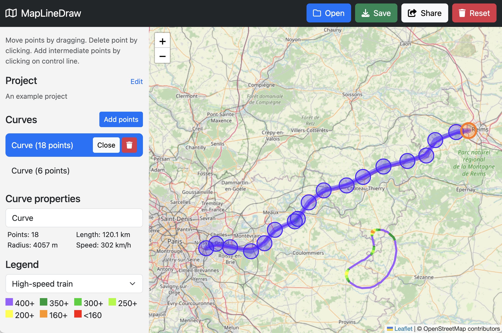
Sketch corridors of railway lines or roads on an interactive map. Draw smooth spline curves on real maps.
Show properties like length and maximum speed.
Free and open source. [maplinedraw.com](https://maplinedraw.com)
## Introduction
MapLineDraw is a free, open source web application that lets you draw smooth curves on a map.
* It lets hobbyists draw infrastructure corridors,
for example railway lines or highways, and share their ideas with others.
* It can be also used as a measurement or data extraction tool: you can for example draw a curve
over existing objects, such as roads, race tracks, railways, or rivers to get their length or
extract their curve data (control points of a spline).
MapLineDraw allows you to:
* Draw smooth curves and show curve properties such as curve length, minimal radius and its corresponding maximum
speed (using a typical design value for comfortable lateral acceleration of railways). Curves are
represented using draggable control points and use B-splines of degree 3, which leads to a continuous curvature.
* Make open or closed (circular) curves. Add, move and remove curve control points as you need.
* Enter project information: Project name, author and description.
* Download your projects as JSON files to save them locally.
* Share projects using sharing links. Those projects can be directly shared with others and open
directly in the web app.
* Show different colored legends (you can edit them in the saved JSON file with a text editor).
Have fun in drafting your visions for the future of public infrastructure!
Note that this is not a professional program for infrastructure projects and does for example not consider
elevation (bridges or tunnels).
Any project you see on [maplinedraw.com](https://maplinedraw.com) is intended only for discussion and idea sharing and does not mean that what you see is a finalized project that will be built in reality.
## Usage
Go to [maplinedraw.com](https://maplinedraw.com) and try it yourself.
### Keyboard shortcuts
* Press d to toggle draw mode.
* Press backspace or del to delete a curve.
* Press esc to unselect curve.
### Limitations
The application does not yet work well on mobile devices.
## Feedback
Having problems or need a feature? [Create an issue](https://github.com/patrsc/MapLineDraw/issues/new) in GitHub.
## Contributing
To contribute source code, fork the repository and create a pull request.
## Develop
### Clone repository
```
git clone https://github.com/patrsc/MapLineDraw.git
cd MapLineDraw
```
### Run API
Change directory:
```
cd api
```
Install dependencies:
```
poetry install
```
Run API:
```
poetry run fastapi dev api.py
```
### Run web site
Change directory:
```
cd web
```
Make sure to install dependencies:
```bash
npm install
```
Start the development server on `http://localhost:3000`:
```bash
npm run dev
```
Build the application for production:
```bash
npm run build
```
Locally preview production build:
```bash
npm run preview
```
Check out the [deployment documentation](https://nuxt.com/docs/getting-started/deployment) for more information.
Look at the [Nuxt documentation](https://nuxt.com/docs/getting-started/introduction) to learn more.
## Deploy
See [Deployment Guide](deploy.md) how to deploy to [maplinedraw.com](https://maplinedraw.com).
## License
License is [MIT](LICENSE.md).
## References
* [maplinedraw.com](https://maplinedraw.com/)
* [Draw Smooth Curves on Real Maps with MapLineDraw](https://medium.com/@patrsc/introducing-maplinedraw-draw-smooth-curves-on-real-maps-free-and-open-source-e1e6a6f9d39e) ([source file](article.md))
* [Future Ideas](ideas.md)