Abel Tasman Coast Track
3-5 days 54.4km / 21mi Map
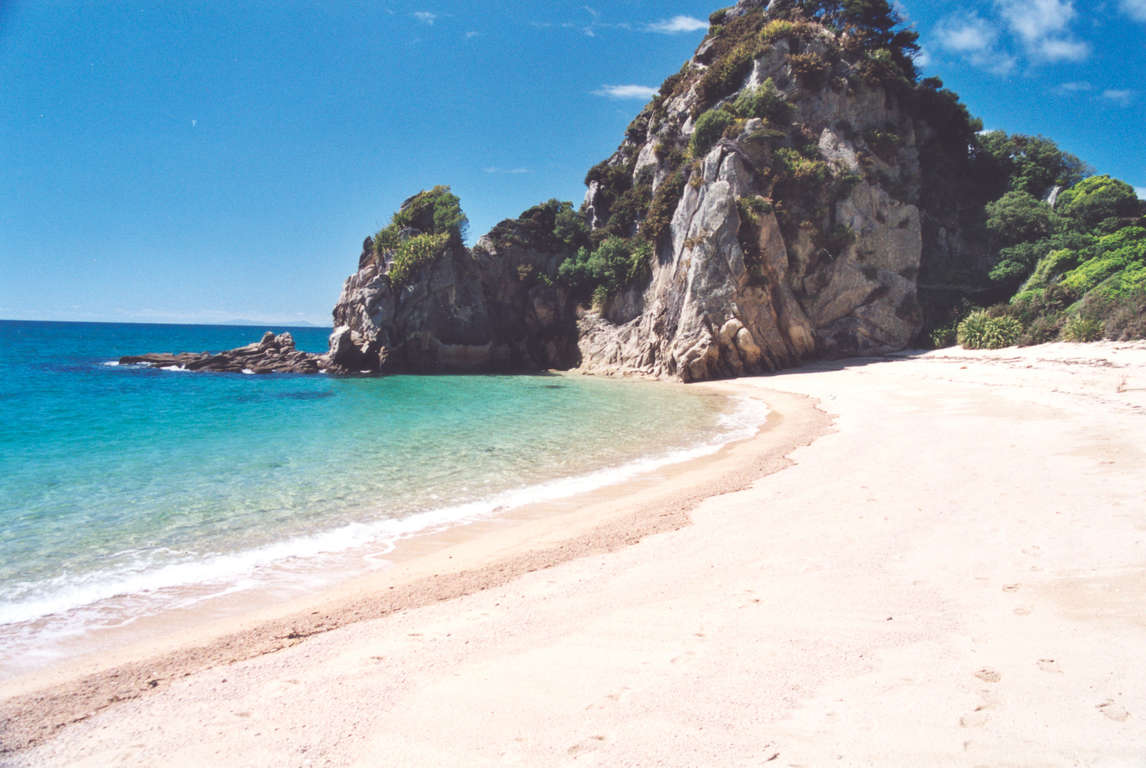
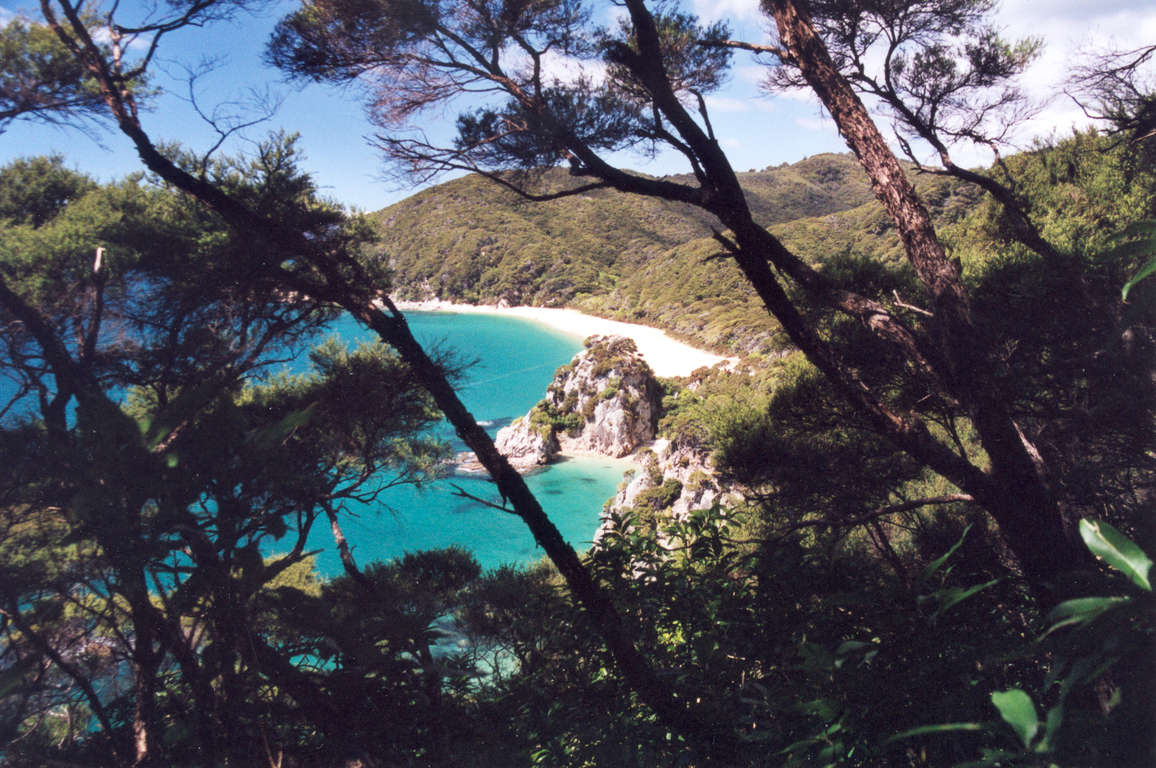
Blessed with a mild climate, golden beaches and lush coastal native bush, the Abel Tasman Coast Track really has it all. Choose to walk the whole track or water taxi or kayak between different locations at any time of the year.

Don't miss


Offers


Before you go
It is important to plan and prepare to be well equipped to enjoy your Great Walk.
Before you go, know The Outdoor Safety Code - 5 simple rules to help you stay safe:
- Plan your trip
- Tell someone
- Be aware of the weather
- Know your limits
- Take sufficient supplies
Abel Tasman Track safety
- Be sure to consult a tide timetable when planning your trip as Onetahuti and Awaroa estuaries on the track are only passable at low tide.
- While the Abel Tasman Coast is generally warm and dry in summer, remember it is a coastal environment which can change quickly so be prepared for rain, cold and windy conditions.
- Cell phone coverage on the track is limited.
Things to know before you go
- A good level of fitness and the right outdoor clothing and equipment will greatly improve the enjoyment of your trip.
- Safety is your responsibility - leave your trip details with a trusted contact. Intention forms are available at adventuresmart.org.nz.
- Book your trip well in advance including your accommodation, transport and transfers to the start/end of the Great Walk.
- Pack all necessary equipment, your own food and drinks and any personal items for your trip including an extra day's supply of food and water.
- For a comprehensive equipment list and preparation required for this walk please visit the DOC website.
When to go
The track is open all year and is most popular during the peak season (October to April) when the weather is warmer and daylight hours are longer. Transport, activity, equipment and accommodation operators are available year round. Walking the track during the winter months (June - August) also has its advantages with fewer visitors, calmer water, hardly any insects and less water traffic.
What to bring
Your basic equipment needs to include
- Backpack
- Sleeping bag and liner
- Portable cooking stove
- Cooking utensils
- Food, incl. high-energy food
- Waterproof rain jacket and overtrousers
- Warm/thermal clothing
- Hiking boots
- Map and compass
- Lighter and matches
- Drink bottle & water
Add camping gear to your list if you’re staying at a campsite.
Travelling with children
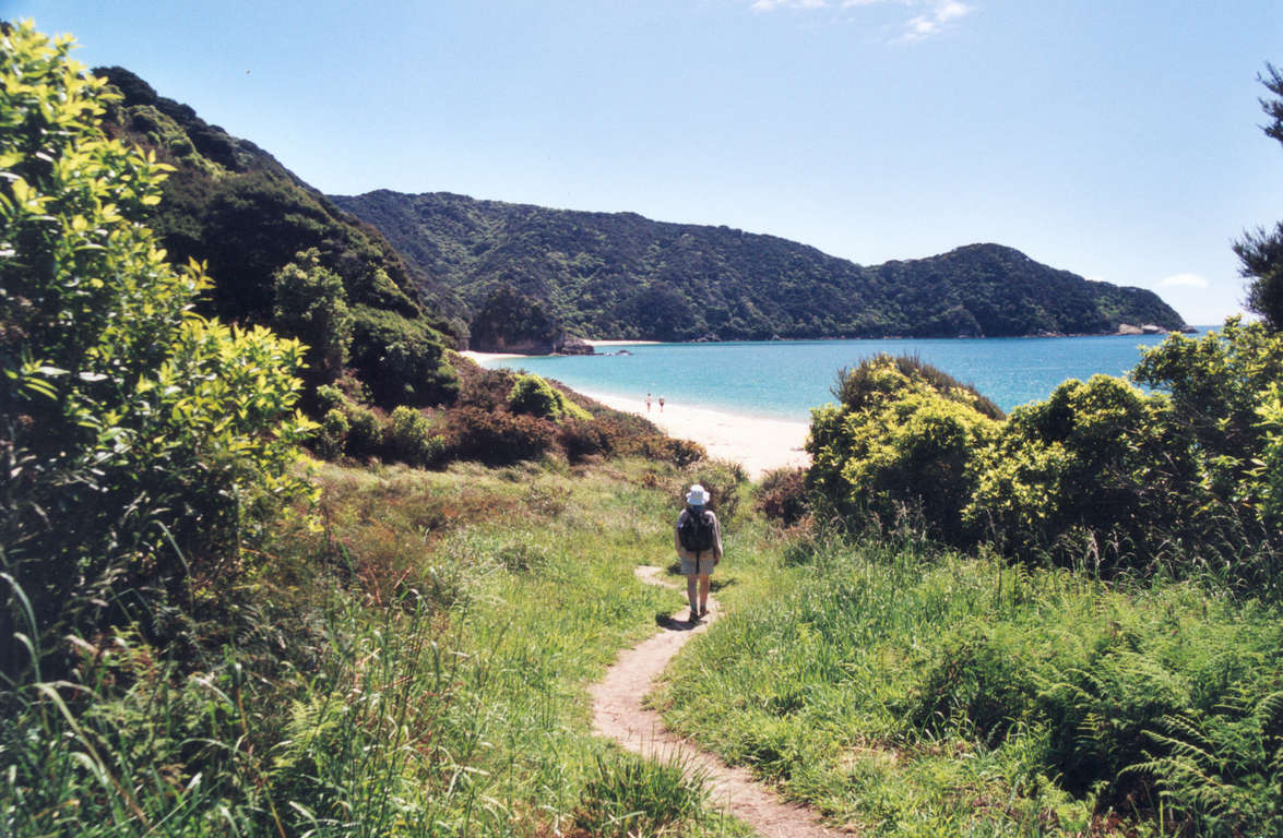
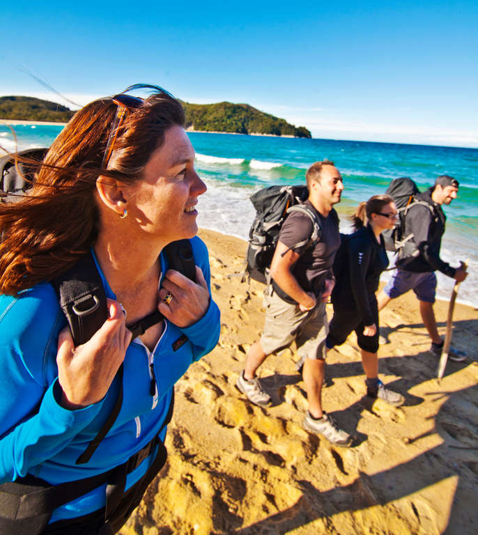
The Abel Tasman Coast Track is an easy coastal walk for families with half or multi day options available. Visitors can walk into the park from the road end car parks, catch water taxis to beaches along the track or kayak along the coast.
Nearest DOC visitor centre
DOC Nelson Regional Visitor Centre
79 Trafalgar Street
Nelson 7010
+64 3 546 9339
nelsonvc@doc.govt.nz
Hours
Open daily 8:30 am - 4:30 pm
Closed daily 12:00 pm - 1:00 pm
Services
Great Walks bookings and recreation information for the area.
Getting there
Nearest airports
Nelson - 65km / 40mi, 1 hour
Flights to this airport typically connect from Auckland, Wellington and Christchurch. The above driving times are indicative only - always allow for extra time to get to your destination.
How to get to the trailhead
The Abel Tasman Coast Track is accessible by road at four points, each with a carpark:
- Marahau, the southern gateway, is 67km / 42mi from Nelson on sealed road.
- Wainui is 21km / 13mi from Takaka. For the last 2km / 1mi, the road is unsealed.
- Totaranui is 32km / 20mi from Takaka. For the last 12km / 7mi, the road is unsealed.
- Awaroa estuary is 31km / 19mi from Takaka. The last 12km / 7mi of road is rough and unsealed. There are two fords, which flood after heavy rain. From the Awaroa carpark on the northern side of the estuary, it’s 25 minutes of tidal walk to Awaroa hut and campsite, which are on the southern side of the estuary.
The track is well serviced by public transport including buses/coaches and boat transport.
Bus services operate in summer from Nelson and Motueka to the major road ends at Marahau and Kaiteriteri, and connect with Takaka transport to Totaranui and Wainui. Bookings are recommended. In winter, bus services operate daily to Marahau and Kaiteriteri but not so regularly to Wainui and Totaranui.
Water taxis operate year round from Marahau and Kaiteriteri. The scheduled water taxi pick up locations are: Anchorage, Torrent Bay, Bark Bay, Onetahuti, Awaroa and Totaranui.
Transport and accommodation
Guides and commercial tourism providers - find accommodation, transport, and activities in the area.
Where to stay
DOC provides four huts and eighteen campsites along the Abel Tasman Coast Track.
Huts
Abel Tasman Coast Track huts have heating, toilets, bunks, mattresses and cold running water. Note: Huts do not provide lighting, pots and pans, cooking utensils, linen or food for purchase. You will need carry your own portable gas cooker, lighter and spare fuel as there is no gas cooking provided at huts on the Abel Tasman Coast Track. Make sure you put these things on your checklist before you go.
- Anchorage Hut: 24 bunks
- Awaroa Hut: 26 bunks
- Bark Bay Hut: 34 bunks
- Whariwharangi Hut: 20 bunks
Campsites
Campsites offer basic facilities including toilets, sinks and a water supply. Some also have picnic tables and cooking shelters. Open fires are only permitted where fireplaces are provided. Campers are not permitted to use the hut facilities.
Note: It is possible to arrange for luggage to be carried by boat between huts and campsites. If you choose this option, be prepared for a change in the weather and what this might mean for your luggage drop off (possibly in a different bay).
Cost and booking
Fees are charged per person, per night to stay in huts and campsites.
Bookings are essential! Use the DOC online booking system prior to travel or call 0800 NZ GREATWALKS.
On the track
Track description
The Abel Tasman Coast Track is an easy coastal walk for families with half or multi day options available. Visitors can walk into the park from the road end car parks, catch water taxis to beaches along the track or kayak along the coast.
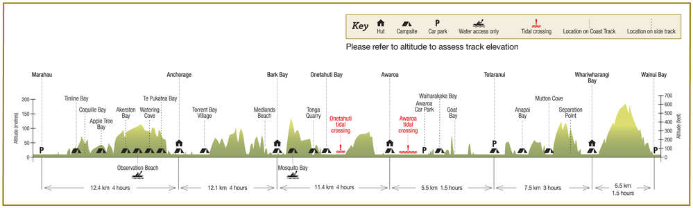
Elevation profile
The elevation of this track goes from sea level to about 150 m. The highest point on the track is between Whariwharangi Bay and Wainui Bay. Note the altitude level when you view the elevation profile.
Walking guide
Day 1: Marahau to Anchorage
4 hours, 12.4km / 4.8mi
Cross the estuary over the Marahau causeway and follow the track through open country to Tinline Bay. Round Guilbert Point to Apple Tree Bay and pass through beech forest with large kānuka trees. After Yellow Point the track turns inland, winding in and out of several little gullies before emerging in open country that overlooks beautiful Torrent Bay. Descend to Anchorage Hut and Campsite.
Anchorage to Bark Bay
High tide: 4 hours, 12.1km / 4.7mi.
Low tide: 3 hours, 8.4km / 3.2mi
From Anchorage, cross a low ridge to Torrent Bay estuary. The estuary can be crossed within two hours either side of low tide or an all-tide track leads around it to Torrent Bay. At the northern end of Torrent Bay beach the track climbs steadily and then sidles around two valleys to Falls River, which is crossed by a 47 metre suspension bridge. Beyond the river, the track meanders through lush coastal forest before leading back to the sea. Follow the track to the hut and campsite beside Bark Bay estuary.
Day 3: Bark Bay to Awaroa (tidal)
4 hours, 11.4km / 4.4mi
Cross Bark Bay estuary or follow the all-tide track (10 minutes) around the edge of the estuary and climb steeply to a saddle and journey through stands of mānuka. Return to the shore at Tonga Quarry with a short walk to Onetahuti Bay. The tidal stream can be crossed within 3 hours either side of low tide. The track then climbs over Tonga Saddle and descends to Awaroa Inlet. Follow the shore to Awaroa Hut and Campsite.
Day 4: Awaroa to Whariwharangi Bay (tidal)
4.5 hours, 13km / 8mi
Awaroa Inlet can only be crossed up to one and a half hours before low tide and up to two hours after it. The track crosses a low saddle and drops to Waiharakeke Bay before re-entering the forest and emerging at Goat Bay. Climb to a lookout above Skinner Point before descending to the Totaranui Campsite. The track heads around Totaranui estuary, climbs over a low saddle and winds through lush forest to Anapai Bay. From here to Mutton Cove the scenery alternates between sandy beaches and rocky headlands of regenerating kānuka trees. Descend to Whariwharangi Bay, the hut and campsite are just behind the beach.
Day 5: Whariwharangi Bay to Wainui Bay
1 hour, 5.5km / 2.1mi
Follow a stream and climb out of the bay to a saddle overlooking Wainui Inlet. The track winds down to the shore and follows the estuary edge to the carpark.
Optional side tracks
Te Pukatea Bay and Pitt Head
1 hour 20 min
A 20 minute walk crosses a low ridge from Anchorage Hut to crescent shaped Te Pukatea Bay. From there, a one hour walk with great views leads to Pitt Head, an old pa site, and back to Anchorage.
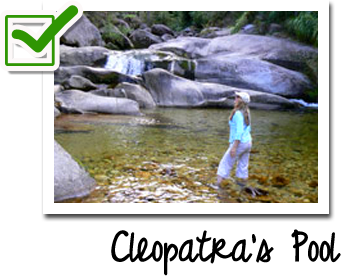
Cleopatra's Pool
20 min
From Torrent Bay estuary, a 20 minute walk leads up a stream bed of large boulders to Cleopatra's Pool.
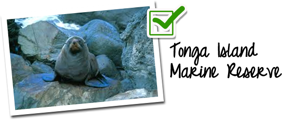
Separation Point
1 hour
From Mutton Cove a track leads to Separation Point, where fur seals breed. This track branches shortly before the Point to rejoin the coast track at the saddle above Whariwharangi Bay.