Lake Waikaremoana
3-4 days 46km / 29mi Map
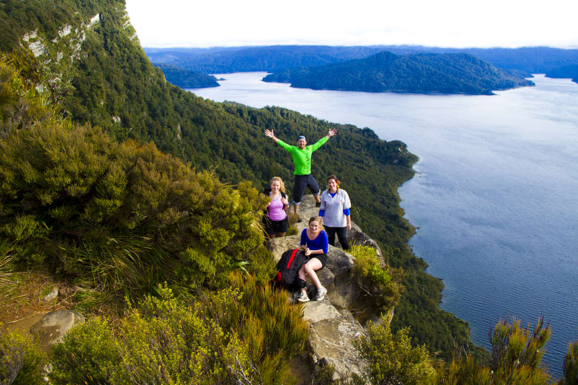
Trace the shores of the beautiful Lake Waikaremoana, the “sea of rippling waters”. Get a glimpse of how New Zealand used to be: explore the prehistoric rainforests, marvel at the giant podocarps, visit remote beaches and deepen your imagination with this Great Walk’s rich spiritual and cultural history. Te Urewera National Park is the home of Ngāi Tūhoe. It also offers access to some of New Zealand’s most iconic birds, including kiwi, kererū and kākā.

Don't miss


Offers


Before you go
It is important to plan and prepare so that you are well equipped to enjoy your Great Walk.
Before you go, know The Outdoor Safety Code - 5 simple rules to help you stay safe:
- Plan your trip
- Tell someone
- Be aware of the weather
- Know your limits
- Take sufficient supplies
Lake Waikaremoana safety
- This track is not recommended for children under the age of 10 due to the exposed mountainous environment and possible adverse weather conditions.
- Lake Waikaremoana lies between altitudes of 600-1200m / 3937ft. Cold temperatures, snow, strong winds and heavy rain can occur at any time of the year. You must be self-sufficient and responsible for ensuring your own safety while walking.
- Cell phone coverage on the track is limited.
Things to know before you go
- A good level of fitness and the right outdoor clothing and equipment will greatly improve the enjoyment of your trip.
- Safety is your responsibility - leave your trip details with a trusted contact. Intention forms are available at adventuresmart.org.nz.
- Book your trip well in advance including your accommodation, transport and transfers to the start/end of the Great Walk.
- Pack all necessary equipment, your own food and drinks and any personal items for your trip, including an extra day’s supply of food and water. Food and drinks are not available for purchase at Great Walks huts and campsites.
- For a full list of equipment and preparation required for this walk, plus track updates for Lake Waikaremoana, please visit the DOC website.
When to go
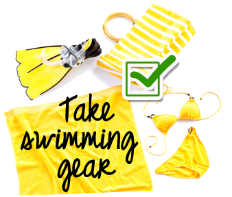
You can do this walk year-round but if you want to take advantage of the great swimming opportunities, you should go in summer (remember, that’s December - February/March).
What to bring
Your basic equipment needs to include
- Backpack
- Sleeping bag and liner
- Portable cooking stove
- Cooking utensils
- Food, incl. high-energy food
- Waterproof rain jacket and overtrousers
- Warm/thermal clothing
- Hiking boots
- Map and compass
- Lighter and matches
- Drink bottle & water
Add camping gear to your list if you’re staying at a campsite.
Travelling with children
Lake Waikaremoana is a moderate walk and suitable for families with children. You can do part of the track on a water taxi or have part of your luggage transported that way.
Nearest DOC visitor centre
Aniwaniwa Visitor Centre
Te Urewera National Park
State Highway 38 RD 5
Aniwaniwa
+64 6 837 3900 (Great Walks bookings)
urewerainfo@doc.govt.nz
Hours
Open daily 8:00 am - 5:00 pm
Services
Lake Waikaremoana Great Walks bookings, boat hire, hunting permits and recreation information for the area.
Getting there
Nearest airports
- Napier - 180km / 112mi, 2 hours
- Rotorua - 150km / 93mi, 3 hours 30 minutes. Note: The driving time is longer from Rotorua as SH 38 is unsealed for approximately 90km / 56mi from Murupara to Aniwaniwa.
Flights to any of these airports typically connect from Auckland or Wellington. The above driving times are indicative only - always allow for extra time to get to your destination.
How to get to the trailhead
The track can be accessed by car or you can arrange shuttle transport through a tour operator.
Note: The track is located deep inside Te Urewera National Park, so access to the trailhead is at least partially on windy, narrow, and unsealed roads through the rainforest. The scenery is beautiful - just don’t forget that your drive to the trailhead will take considerably longer than on regular roads. Also, note that for much of the Te Urewera Rainforest Route there is no cell phone reception.
You can start your walk either from Onepoto or Hopuruahine along the Te Urewera Rainforest Route (SH38). Both trailheads can also be accessed by water taxi from the Waikaremoana Motor Camp, Aniwaniwa, which has secure car parking and a DOC visitor centre close by.
Transport and accommodation
Guides and commercial tourism providers - find accommodation, transport, and activities in the area
Where to stay
DOC provides five huts and five campsites around Lake Waikaremoana.
Huts
The Lake Waikaremoana huts have bunks, mattresses, heating, cold water, cooking benches and vault toilets. Note: Huts do not provide lighting, pots and pans, cooking facilities, toilet paper, linen or food for purchase. Make sure you put these things on your checklist before you go.
- Panekire Hut: 36 bunks
- Waiopaoa Hut: 30 bunks
- Marauiti Hut: 26 bunks
- Waiharuru Hut: 40 bunks
- Whanganui Hut: 18 bunks
Campsites
Lake Waikaremoana campsites have cooking shelters, grassed tent sites, a water supply and toilets. Campers are not permitted to use the hut facilities.
Cost and booking
Fees are charged per person, per night to stay in huts and campsites.
Bookings are essential! Use the DOC online booking system prior to travel or call 0800 NZ GREATWALKS.
On the track
Track description
Lake Waikaremoana can be walked in either direction. This guide describes a clockwise route from Onepoto to Hopuruahine - however many people prefer walking the track counter-clockwise.
There are a number of transport providers to assist you with pickups and dropoffs, either by road or water taxi. Please visit your friendly team at the Te Urewera National Park Visitor Centre or check the directory of providers on the DOC website.
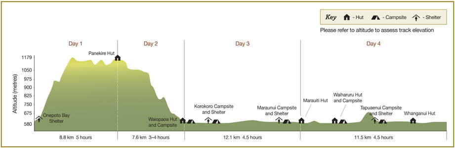
Elevation profile
This track has one longer climb up the Panekire Bluff, where you first ascend then descend about 600m / 1969ft. Aside from this, there are only moderate elevation changes. Note the altitude level when you view the elevation profile!
Walking guide
Day 1: Onepoto to Panekire Hut
4-6 hours, 9km / 6mi
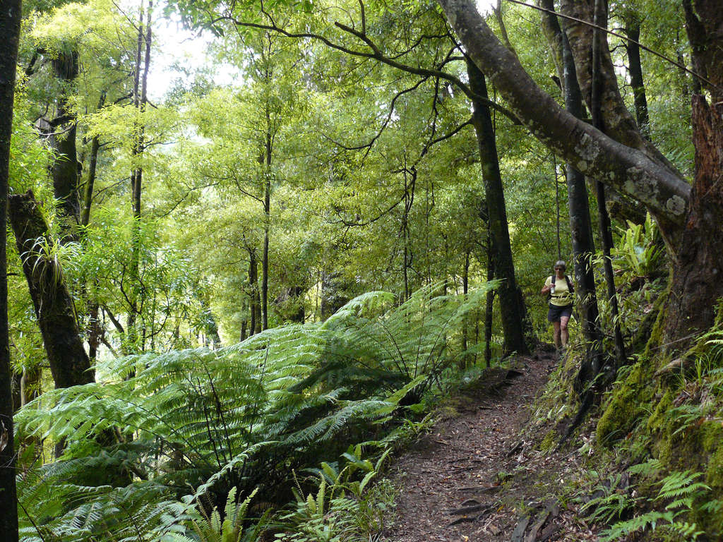
This is the most strenuous part of the trip. The views from Panekire make it really worthwhile. The track starts from the Onepoto Shelter through the former Armed Constabulary Redoubt and climbs steadily up to the top of Panekire Bluff. It then follows the undulating ridgeline before reaching Puketapu Trig (1180 metres) and onto Panekire Hut.
Day 2: Panekire Hut to Waiopaoa Hut
3-4 hours, 8km / 5mi
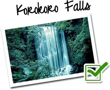
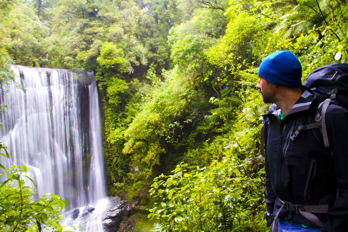
From Panekire Hut, the track heads south-west down the range to the top of the Panekire descent. From here the track drops steeply off the range into rolling valleys of beech, podocarp and kāmahi forest and the lake. The Waiopaoa Hut makes a good stopping point for lunch. Have a relaxing afternoon and take the short walk up the side track from the Korokoro Campsite to the must-see waterfalls (2 hours return.)
Day 3: Waiopaoa Hut to Marauiti Hut
4-5 hours, 12km / 7mi
Day 3 sees the track head up the Waiopoa Stream a short distance before crossing grassy flats and heading through kānuka forest on the lake shore. The undulating track weaves up and over a number of small ridges, through young rimu wooded areas and along the lake edge. You can either stay at Marauiti, or push through to Waiharuru Hut - this is a great spot to stop for the night - at dusk go for a walk to the edge of Puketukutuku Peninsula where you may hear the call of the kiwi.
Day 4: Marauiti Hut to Hopuruahine
4-5 hours, 11km / 7mi
This is another moderate day of walking with plenty of fantastic photo opportunities. The track ends with a classic New Zealand suspension bridge.
Fantastic side trip
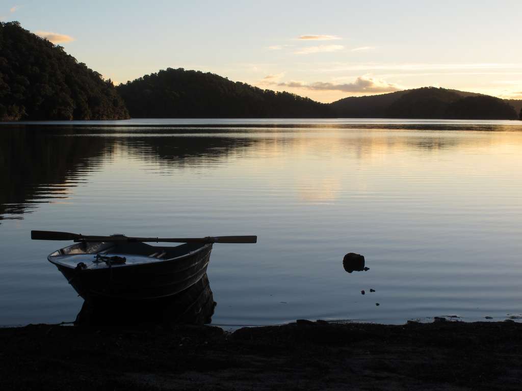
Spend an extra day at Waikaremoana and take a stroll up the hill from Te Urewera National Park Visitor Centre to explore another amazing lake - Lake Waikareiti. Hire a boat from the Visitor Centre at Aniwaniwa before departing to Lake Waikareiti and spend some time on the water. Or row out to Rahui Island where you can take another short walk to enjoy the views of Lake Te Tamaiti-o-Waikaremoana. It’s a lake on an island in a lake!