Tongariro Northern Circuit
3-4 days 51.5km / 19.9mi Map
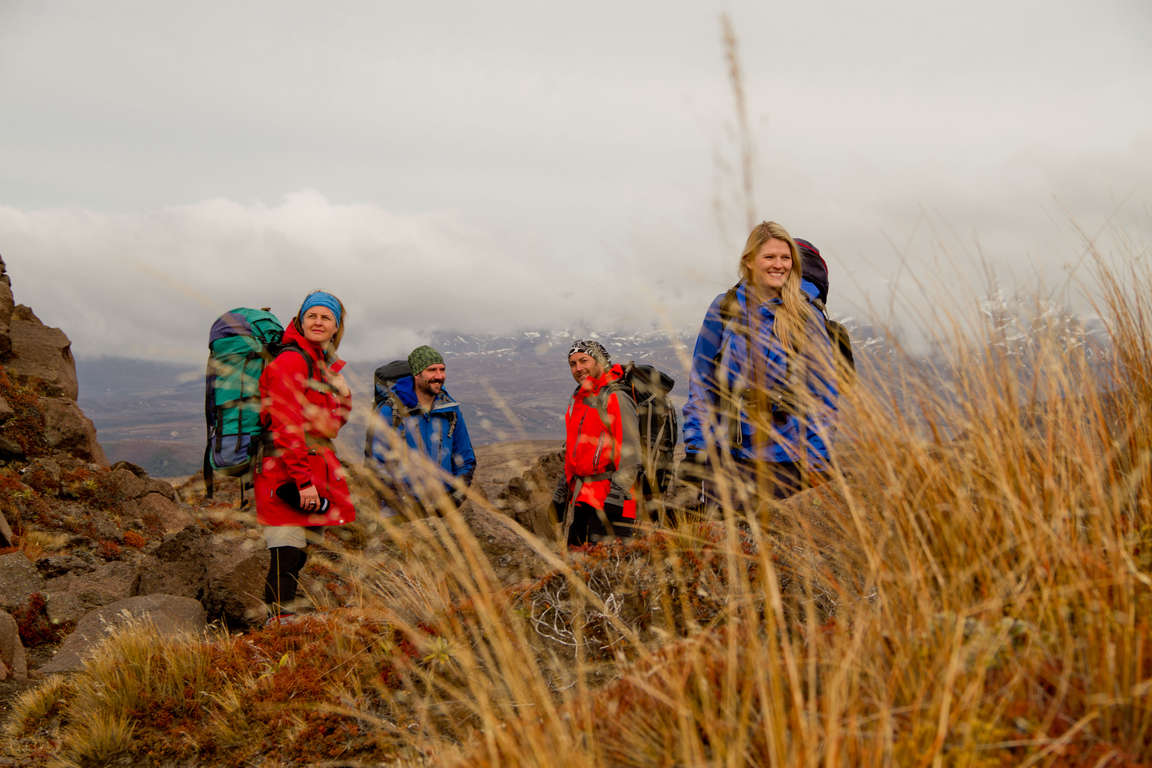
Winding its way over Mt Tongariro and around Mt Ngauruhoe, this walk passes through unique and stunning landforms including active volcanic craters, brilliant blue lakes, steaming geothermal areas, and glacial valleys. From alpine herb fields to forests, from tranquil lakes to desert-like plateau, this walk is a place of extremes and surprises.

Don't miss


Offers


Before you go
It is important to plan and prepare so that you are well equipped to enjoy your Great Walk.
Before you go, know The Outdoor Safety Code - 5 simple rules to help you stay safe:
- Plan your trip
- Tell someone
- Be aware of the weather
- Know your limits
- Take sufficient supplies
Tongariro Northern Circuit safety
- The Tongariro Northern Circuit is considered challenging – often covering exposed terrain, with much of it on uneven track surfaces. Reasonable fitness is required. Cold temperatures, snow, strong winds and heavy rain can occur at any time of the year. You must be self-sufficient and responsible for ensuring your own safety while walking.
- The area is subject to volcanic activity, please check the current Volcanic Alert Level.
- There is a risk of Giardia. Boil, filter or chemically treat water if you doubt its purity.
- Cell phone coverage on the track is limited.
Things to know before you go
- A good level of fitness and the right outdoor clothing and equipment will greatly improve the enjoyment of your trip.
- Safety is your responsibility - leave your trip details with a trusted contact. Intention forms are available at adventuresmart.org.nz.
- Book your trip well in advance including your accommodation, transport and transfers to the start/end of the Great Walk.
- Pack all necessary equipment, your own food and drinks and any personal items for your trip, including an extra day’s supply of food and water. Food and drinks are not available for purchase at Great Walks huts and campsites.
- For a full list of equipment and preparation required for this walk plus track updates for Tongariro Northern Circuit, please visit the DOC website.
When to go
The Tongariro Northern Circuit can be walked in either direction. The safest and most popular time of year to walk this track is during the summer months (December - March) when the tracks are normally clear of snow and the weather is less severe.
What to bring
Your basic equipment needs to include
- Backpack
- Sleeping bag and liner
- Portable cooking stove
- Cooking utensils
- Food, including high-energy food
- Waterproof rain jacket and overtrousers
- Warm/thermal clothing
- Hiking boots
- Map and compass
- Lighter and matches
- Drink bottle & water
Add camping gear to your list if you’re staying at a campsite.
Travelling with children
The circuit is a moderately challenging hike, mostly on open and exposed volcanic terrain and is not recommended for children under the age of 10. However, there are a range of shorter walking opportunities, suitable for the whole family and for those with less time available. You can do a walk of a few hours or a whole day, or an overnight stay in one of the huts or campsites.
Nearest DOC visitor centre
Tongariro National Park Visitor Centre
Whakapapa Village State Highway 48
Mount Ruapehu
+64 7 892 3729
tongarirovc@doc.govt.nz
Hours
Summer (Dec - Feb):
8:00 am - 6:00 pm daily (closed Christmas Day)
Winter (Mar - Nov):
8:00 am - 5:00 pm daily
Services
Great Walks bookings and recreational information for the area.
Getting there
Nearest airports
Taupo - 98km / 61mi, 1 hour
Flights to this airport typically connect from Auckland and Wellington. The above driving times are indicative only - always allow for extra time to get to your destination.
How to get to the trailhead
Tongariro National Park is easy to get to from around the North Island. The Tongariro Northern Circuit is easily accessible from four trailheads, with Whakapapa Village, State Highway 48, Mount Ruapehu being the main entrance and exit point.
The following locations have parking areas or you can arrange shuttle transport through a tour operator. Whakapapa Village; the end of Mangatepopo Road; the end of Ketetahi Road; and just off the Desert Road (State Highway 1), 35km / 22mi south of Turangi.
Located in the central North Island, the nearest towns are National Park Village, Turangi, Ohakune and Taupo, in addition to Whakapapa Village.
Transport and accommodation
Guides and commercial tourism providers - find accommodation, transport, and activities in the area.
Where to stay
DOC provides four huts and campsites on the Tongariro Northern Circuit.
Huts
Tongariro Northern Circuit huts have heating, toilets, bunks, mattresses, cooking facilities and cold running water. Note: huts do not provide lighting, pots and pans, cooking utensils, linen or food for purchase. Make sure you put these things on your checklist before you go.
- Ketetahi Hut: 26 bunks (note: this hut is closed for repairs for the 2012/2013 season)
- Mangatepopo Hut: 20 bunks
- Oturere Hut: 26 bunks
- Waihohonu Hut: 28 bunks
Campsites
Campsites can be found adjacent to each of the huts and have a water supply and toilets. Facilities at the huts can be used while camping.
Cost and booking
Fees are charged per person, per night to stay in huts and campsites.
Bookings are essential! Use the DOC online booking system prior to travel or call 0800 NZ GREATWALKS.
On the track
Track description
The Tongariro Northern Circuit starts and finishes at Whakapapa Village, State Highway 48, Mount Ruapehu. You can walk the track in either direction - but normally you start at Mangatepopo, as the altitude (1120m / 3675ft) is higher than at Ketetahi (760m / 2493ft) so there is less climbing involved. Shuttle buses operate for walking in this direction, with services to Mangatepopo in the morning and back from Ketetahi in the afternoon. Allow an extra hour to walk the track in reverse from Ketetahi to Mangatepopo.
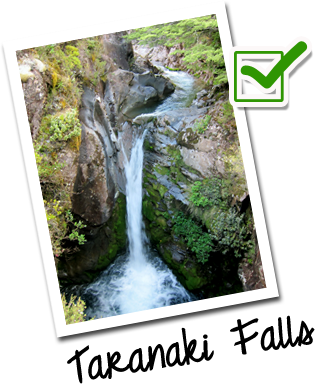
Elevation profile
The altitude on this track varies - the lowest point is 1120m / 3675ft above sea level, the highest point is 1886m / 6188ft. Note the altitude level when you view the elevation profile!
Walking guide
Whakapapa Village to Mangatepopo Hut
3 hours, 8.5km / 3.3mi
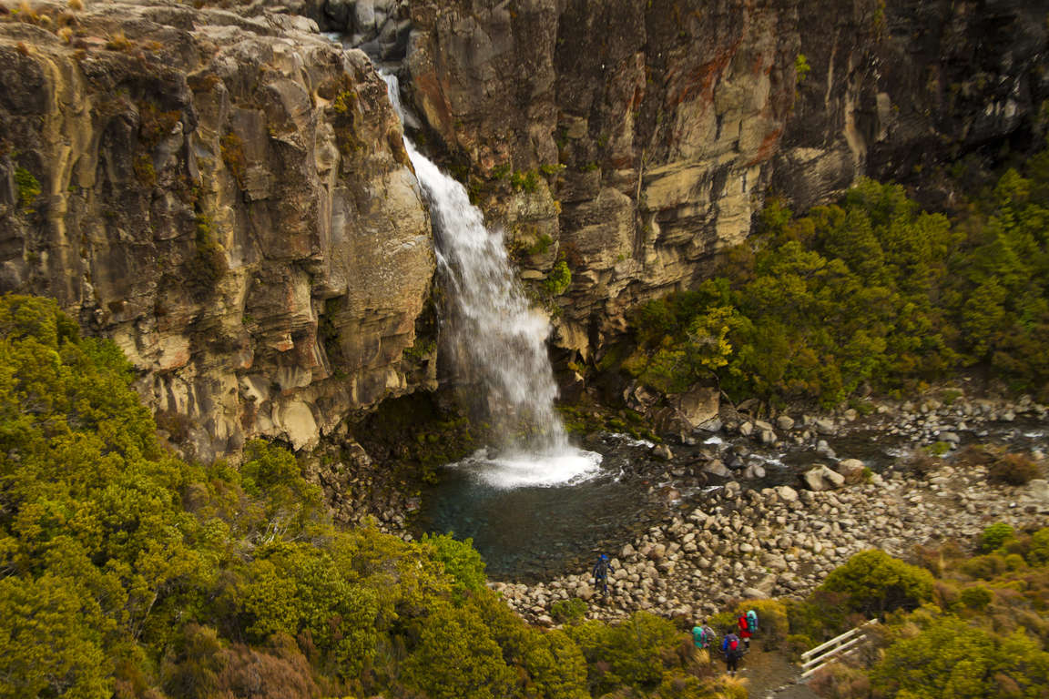
Begin 100m / 328ft below the Whakapapa Visitor Centre and head along the Taranaki Falls track where after 20 minutes you can choose to take a detour to the falls. Heavily eroded in some places, this track crosses many stream beds. Through here you can view the Pukekaikiore vent and the Pukeonake scoria cone, both of which were present during the last ice age.
Mangatepopo Hut to Emerald Lakes
3.5 hours, 8km / 5mi
Follow Mangatepopo stream up the valley and across a number of lava flows from Ngauruhoe, the youngest from a 1954 eruption. A five minute detour can take you to Soda Springs, where cold springs emerge from an old lava flow. The steep climb to the top of Mangatepopo Saddle will reward you with views across the valley. Cross the South crater, Red crater and North crater and follow the track down towards the Emerald Lakes, where you can see three filled explosion pits, brilliantly coloured by the minerals washed down from the thermal area.
Emerald Lakes to Ketetahi Hut
1.5 hours, 4.2km / 1.6mi
Cross the central crater and the climb up to the ridge beside Blue Lake, which has formed where fresh water fills an old volcano vent. The track continues around the North crater where views of Lake Rotoaira and Taupo can be seen. You can complete the Tongariro Alpine Crossing here by continuing on past the Ketetahi Hut, through tussock land down to the Ketetahi car park.
Ketetahi Hut to Oturere Hut
1.5 hours, 4.8km / 1.9mi
The Emerald Lakes track descends into the Oturere Valley and weaves through an endless variety of unusual jagged lava forms. A magical place to visit on a misty day. The hut has views of the waterfall from the ridge.
Oturere Hut to Waihohonu Hut
3 hours, 7.5km / 2.9mi
Trek over a number of streams valleys and open gravel fields. Plant growth here is repressed due to the high amount of volcanic activity and loose gravel. Travel around the foothills of Ngauruhoe, cross the Waihohonu Stream and continue through a beech-clad valley up to the ridge top.
Waihohonu Hut to Whakapapa Village
5.5 hours, 14.3km / 5.5mi
Follow the Waihohonu Stream and gradually climb towards Tama Saddle. Pick one of two side tracks to visit the Tama Lakes, two in-filled explosion craters. The lower track is a 10 minute walk while the upper lake is up a steep ridge and can take 1.5 hours. Whakapapa village is a 2 hour walk from the Tama Lakes junction.