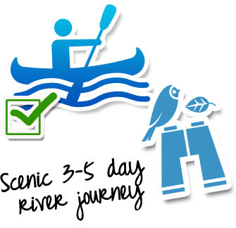
Whanganui Journey
3-5 days 145km / 90mi Map
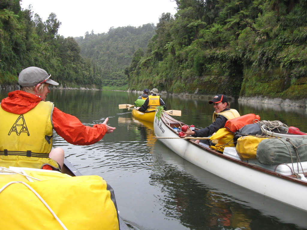
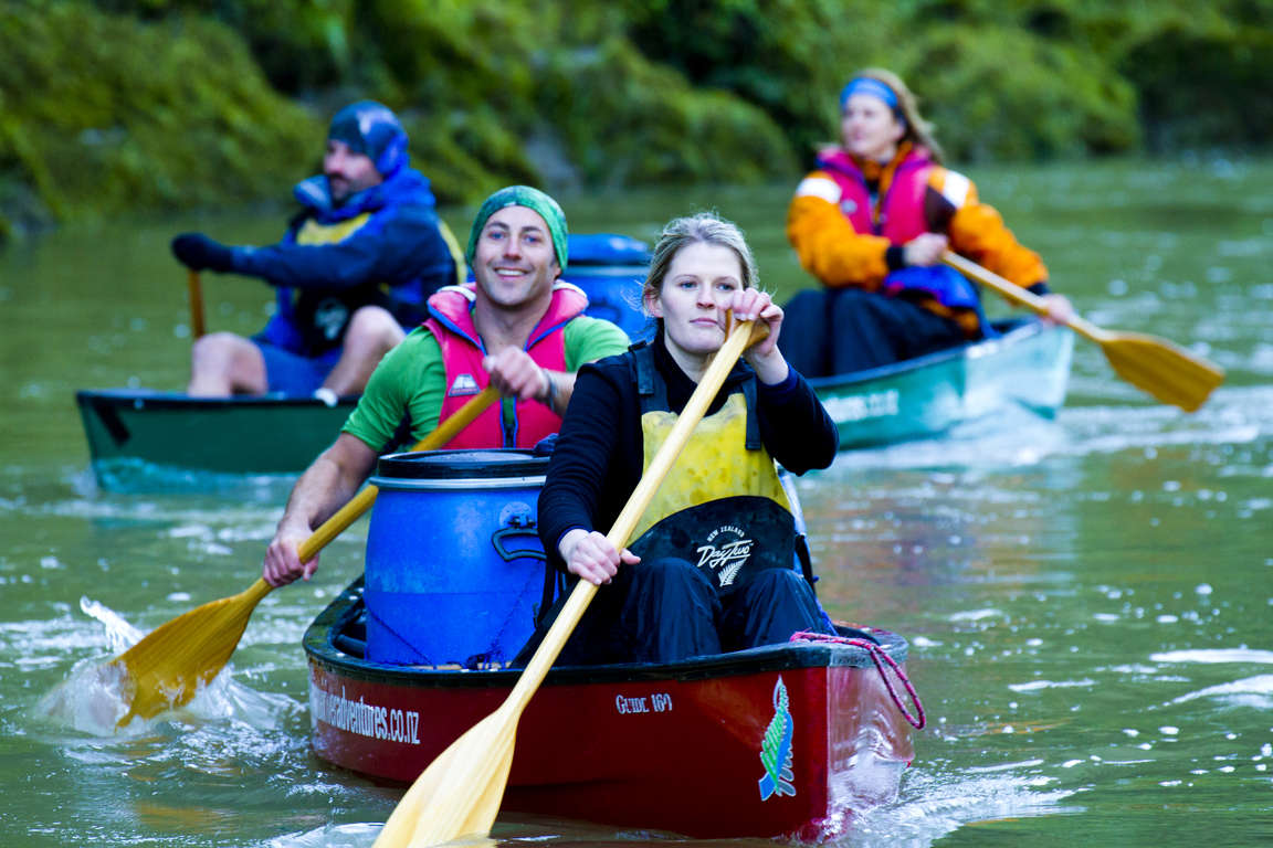
The Whanganui River winds its way from the mountains to the Tasman Sea through countless hills and valleys. This journey takes you on a multi-day canoe or kayak trip to experience its most remote scenic beauty, history and cultural significance.

Don't miss


Offers


Before you go
It is important to plan and prepare so that you are well equipped to enjoy your Whanganui Journey.
Before you go, know The Outdoor Safety Code - 5 simple rules to help you stay safe:
- Plan your trip
- Tell someone
- Be aware of the weather
- Know your limits
- Take sufficient supplies
Whanganui Journey safety
- Heavy rain and flooding can occur at any time of year on the Whanganui River and the weather can change quickly, so you’ll need to be prepared for rain, cold and windy conditions.
- Don’t canoe the river when water levels are predicted to rise or it’s in flood. If you capsize you may not be able to get back in, or swim to the river’s edge.
- Always pull your canoe up high on the bank and tie it to something secure. It may not be raining on the river, but rain elsewhere in the large catchment can cause the river to rise several metres overnight.
- Cell phone coverage on the Whanganui Journey is limited.
Things to know before you go
- A good level of fitness and the right outdoor clothing and equipment will greatly improve the enjoyment of your trip.
- Safety is your responsibility - Cell phone coverage is limited and it is recommended that you leave your trip details with a trusted contact. Intention forms are available at adventuresmart.org.nz.
- Book your trip well in advance including your accommodation, transport and transfers to the start/end of the Whanganui Journey.
- Pack all necessary equipment, your own food, drinks and any personal items for your trip including an extra day's supply of food and water.
- For a full list of equipment and preparation required, plus updates for the Whanganui Journey, please visit the DOC website.
When to go
The Whanganui Journey can be completed at any time of the year, however the most popular time to paddle down the river is during the summer months (December - February) when the weather is warmer and the days are longer. There are also many other recreational opportunities available in Whanganui National Park to enjoy including swimming, rafting, camping and fishing.
What to bring
Your basic equipment needs to include
- Backpack
- Sleeping bag and liner
- Portable cooking stove
- Cooking utensils
- Food, incl. high-energy food
- Waterproof rain jacket and overtrousers
- Warm/thermal clothing
- Hiking boots
- Map and compass
- Lighter and matches
- Drink bottle & water
Add camping gear to your list if you’re staying at a campsite.
Travelling with children
Although the Whanganui Journey is suitable for beginners the trip is not recommended for children under 12. The river can fill up rapidly if the weather changes and a good level of fitness and the ability to make sound decisions around health and safety are often required.
Nearest DOC visitor centre
Ruapehu i-SITE Visitor Centre
54 Clyde Street
Ohakune
+64 6 385 8427
ohakunevc@doc.govt.nz
Hours
9:00 am - 3:00 pm
Mon - Fri and public holiday weekends
Closed 12:30 - 1:00 pm
Services
Great Walks bookings and recreation information for the area.
Getting there
Nearest airports
- Wanganui - 164km / 102mi, 2 hours (to Taumarunui)
- Taupo - 116km / 72mi, 1 hour 30 min (to Taumarunui)
Wanganui and Taupo Airports are about the same driving distance from the start of the shorter 3 day river journey in Whakahoro, approximately 2.5 hours. Canoe hire, drop off and secure parking are packaged together by tour operators. Some tour operators are based along the Whanganui River Road in Pipiriki, Raetihi and Ohakune and in this instance driving from Wanganui would be the best option. For those keen to complete the longer 5 day river journey driving from Taupo to Taumarunui is quicker, however this depends on where you hire your canoes.
Flights to these airports typically connect from Auckland and Wellington. The above driving times are indicative only - always allow for extra time to get to your destination.
How to get to the trailhead
Traditional entry or exit points for journeys on the river are Taumarunui, Ohinepane, Whakahoro and Pipiriki. Most facilities and services that cater for river travellers are found in Taumarunui, Raetihi, Pipiriki and Ohakune although some facilities are found along the Whanganui River Road to Whanganui. Accommodation is available at all of these places.
Transport and accommodation
Guides and commercial tourism providers - find accommodation, transport, and activities in the area.
Where to stay
DOC provides two huts, a bunkroom and eleven campsites on the Whanganui Journey.
Huts
Whanganui Journey huts have heating, toilets, bunks, mattresses and cold running water and some have cooking facilities. There are no cooking facilities and only limited heating available in the huts during the off peak season (1 May - 30 Sep). Note: Huts do not provide lighting, pots and pans, cooking utensils, linen or food for purchase. Make sure you put these things on your checklist before you go.
- John Coull Hut: 24 bunks
- Tieke Kainga: 20 bunks
- Whakahoro Bunkroom (part of the Whakahoro campsite): 10 bunks
Campsites
The Whakahoro and Ohauora campsites are the only campsites along the Whanganui Journey that are accessible by road. All other campsites and huts are only accessible from the river.
Campsites offer basic facilities including tap water, toilets and picnic tables and shelter for cooking. Campers are not permitted to use hut facilities.
Cost and booking
Fees are charged per person, per night to stay in huts and campsites.
Bookings are essential! Use the DOC online booking system prior to travel or call 0800 NZ GREATWALKS.
On the track
Track description
The river journey from Taumaranui to Pipiriki takes 5 days to complete by canoe (145km / 90mi) or a shorter 3 day journey from Whakahoro to Pipiriki is also possible (83km / 52mi).
Walking guide
Day 1 and 2: Cherry Grove, Taumaranui to Whakahoro
57km / 35mi
Travelling the upper reaches of the Whanganui River, you’ll pass through a mixture of farmland and patches of native bush. A steeper section of the river, it features more frequent rapids so enjoy a bit of excitement as you shoot down them. You can put your canoe in at Ngahuinga (Cherry Grove) in Taumarunui or further downstream at Ohinepane, accessed from River Road (SH 43). Camp beside the murmuring river at Ohinepane, Poukaria or Maharanui Campsites. From here you get the feeling of venturing into the heart of a rich and rugged landscape.
Day 3: Whakahoro to John Coull Hut
37.5km / 14.5mi
Below Whakahoro, where many begin their river journey, you’ll enter the scenic middle reaches of the river. Many begin their journey here. Paddle through deep gorges draped in vegetation and often featuring numerous waterfalls after heavy rain. Past Mangapapa Campsite, take a long loop around the Kirikiriroa Peninsula, pass the Tarepokioere (whirlpool) rapid, which used to pose a danger to riverboats, and then the large overhang known as Tamatea’s Cave. Please do not enter the cave as it is wahi tapu (a sacred place). Below Ohauora Campsite, enter the long Otaihanga Reach, which leads you to your overnight stop at John Coull Hut and Campsite. If you are lucky you may see long-tailed bats fluttering overhead at dusk.
Day 4: John Coull Hut to Tieke Kainga
29km / 18mi
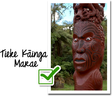
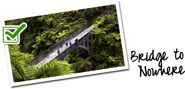
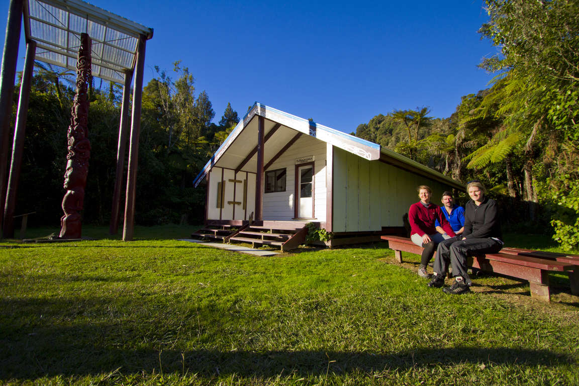
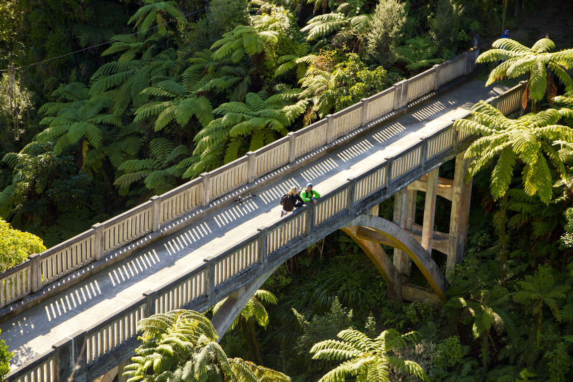
On this section, follow the river as it meanders through bush-covered hills, passing the mouths of the Tangarakau and Whangamomona Rivers where they join the Whanganui. Perched high above the river, Mangawaiiti is an attractive spot to camp or stop for lunch. At Mangapurua Landing, where the old riverboats used to tie up, hop out of your canoe and take a 40 minute bush walk to the historic Bridge to Nowhere, a poignant reminder of the Mangapurua Valley farm settlement, carved out of the bush and then abandoned between the two World Wars. Look out for cyclists - the track is also part of the Mountains to Sea Cycle Trail. Back in your canoe, continue your trip downstream to Tieke Kainga where you can examine the intricately carved pou whenua and learn about the history of Tieke and the tikanga (protocol) of the marae.
Day 5: Tieke Kainga to Pipiriki
21.5km / 8.3mi
This is the homeward stretch, but the river still has a few surprises. You can explore the scenic gorge of the Manganui o te Ao River where it enters the Whanganui after its journey from the slopes of Mount Ruapehu. The standing waves of the large Ngaporo and Autapu rapids can also provide plenty of excitement and perhaps a cool dip on a hot day! More exotic trees and farmland indicate you’re getting close to Pipiriki and the end of your time on the awa. Pass an eel weir on your left, shoot the Paparoa rapid and you will see the boat ramp below Pipiriki village up ahead.